Last week I wrote about the Wildlife Management & Muirburn (Scotland) Bill gaining royal assent and becoming the Wildlife Management & Muirburn (Scotland) Act 2024 (see here).
The next big step in the process of this new legislation being enacted is the provision of the two codes of practice that are required to support the new law – a code of practice for grouse moor management and a code of practice for muirburn.
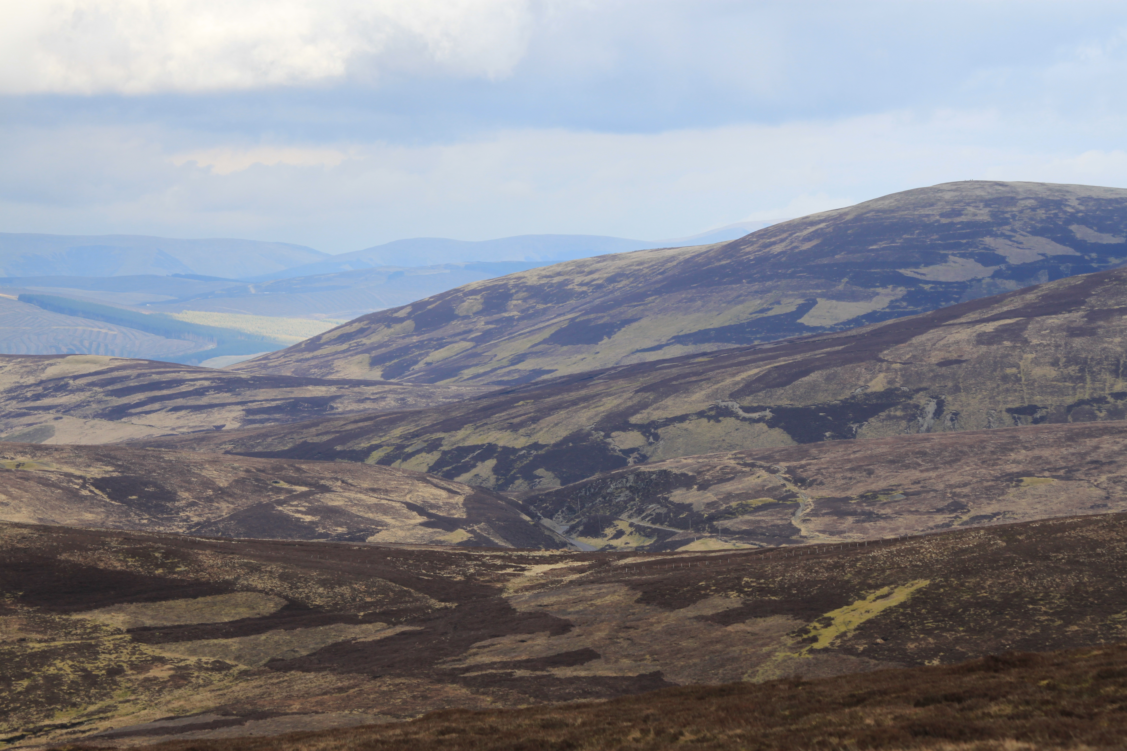
Grouse moors like these at Leadhills (known locally as Dead Hills) in south Scotland will now be subject to licensing rules. Photo by Ruth Tingay
The now former Environment Minister Gillian Martin MSP wrote to the Rural Affairs Committee in January 2024 to set out the progress made so far on developing these two codes of practice (see here).
Last week officials from NatureScot sent a further progress update to those of us who had asked to be kept informed.
As you’ll see (below), progress isn’t exactly speeding along but I think that’s ok – it’s better to take the time and get things right rather than rush through new rules that end up being unworkable or leave gaping loopholes that the grouse shooting industry would happily exploit given half a chance.
Here is the latest progress report from NatureScot (sent prior to the Wildlife Management & Muirburn (Scotland) Bill receiving royal assent):
There’s clearly still a lot of work to do but NatureScot has time. It’s proposed that the grouse moor management code of practice and licensing scheme takes priority and is finalised by mid-summer, presumably in time for it to be up and running by the start of this year’s grouse shooting season on the Inglorious 12th August.
The muirburn code of practice and licensing scheme, as well as details of the mandatory training courses for both muirburn and the use of certain wildlife traps, will then follow. It’s currently anticipated that the code of practice for muirburn will be finalised by early 2025.
It remains to be seen whether the recent election of John Swinney as the new SNP leader (and presumed soon-to-elected First Minister) will have an impact on the development and content of these codes of practice and licences. Swinney will want to appoint his own top team – he’s already promised Kate Forbes MSP “a very involved, senior position” which probably leans more towards deputy First Minister and finance than agriculture/environment but let’s see. There’s speculation that John Swinney will lean towards reshuffling his junior Ministers rather than the Cabinet Secretaries (with the exception of whatever senior role is given to Kate Forbes).
Current Agriculture & Transport Minister Jim Fairlie MSP is currently the nearest the Scottish Parliament has to an Environment Minister, playing a supporting role to the very experienced Cabinet Secretary for Rural Affairs, Land Reform & Islands, Mairi Gougeon. Fairlie has been deeply involved with the development of the Wildlife Management & Muirburn Act, having served on the Rural Affairs Committee that was responsible for the scrutiny of this Bill prior to his appointment as a junior Minister. It’ll be interesting to see whether he’s allowed to continue or whether he’s replaced by someone with less experience of these issues.
UPDATE 7 June 2024: Grouse Moor Management Code of Practice nears completion (here)
In February this year, serial egg collector Daniel Lingham, 71, pleaded guilty to multiple counts of the theft of wild bird eggs (see here). It was the third time he’d been caught, having previously served short prison sentences in 2005 and 2018 for similar offences.
Lingham captured on police body camera whilst officers searched his premises for stolen eggs
His 2018 conviction resulted in him also being given a 10 year Criminal Behaviour Order (CBO), which he has now breached. The consequences of breaching a CBO can result in a lengthy custodial sentence and we were all waiting to see what happened at Lingham’s sentencing hearing last Friday (3 May 2024).
For reasons best known to himself, Magistrate Matthew Watts decided to impose a suspended sentence – 12 weeks jail for the taking of wild birds’ eggs and for two counts of possessing wild birds’ eggs, eight weeks jail for possession of equipment and 12 weeks jail for breaching a Criminal Behaviour Order. All were suspended for 18 months to run concurrently.
Lingham also received a 12 month mental health treatment requirement, 15 rehabilitation days, and was ordered to pay £183 in compensation to the British Trust for Ornithology, £145 court costs and a £154 victim surcharge.
Norfolk Constabulary has issued the following statement following Lingham’s conviction:
MAN SENTENCED FOR STEALING THOUSANDS OF BIRDS’ EGGS
An egg collector who illegally hoarded thousands of wild birds’ eggs has today been sentenced.
Daniel Lingham, 71, of Newton St Faith, Norfolk, was captured on a wildlife trap camera on 9 June 2023 stealing two eggs from a Nightjar nest in Holt Lowes.
A subsequent search of his home revealed he had amassed 2995 eggs most of which (2429) were protected by the Wildlife and Countryside Act.
Of those 548 were from native birds on the amber list of birds of conservation concern and a further 546 were of the most serious concern on the red list including Linnet, Green Finch, Yellowhammer, House Sparrow and many more.
Members of Norfolk Constabulary’s Rural Crime Team with part of Lingham’s illegal egg collection. Photo via Norfolk Constabulary
A further collection of eggs – which looked much newer – was found behind the bath panel including a box containing a pair of Nightjar eggs with a label ‘Nightjar 2, Holt Lowes June 9.’
Officers also found identifying books, binoculars, and an egg blowing kit.
Lingham admitted to five offences at an earlier hearing in February.
Appearing for sentencing at Norwich Magistrates’ Court on Friday 3 May 2024 he was handed 12 week jail sentences for the taking of wild birds’ eggs and for two counts of possessing wild birds’ eggs, eight weeks for possession of equipment and 12 weeks for breaching a Criminal Behaviour Order.
All were suspended for 18 months to run concurrently.
He was also handed a 12 month mental health requirement, 15 rehabilitation days, and ordered to pay £482 in costs, compensation, and victim surcharge.
Lingham had previously been convicted of similar offences in 2005 and 2018 and still has four years of a ten year Criminal Behaviour Order left to run.
PC Chris Shelley from the Op Randall Rural Crime Team said: “It is disappointing that we were here again for a third time with Lingham again having taken whole clutches of eggs for his personal collection and having a huge negative impact on local wild bird populations.
“Having today been sentenced we hope this is an opportunity for him to reflect on his behaviour and get the help he needs to end his illegal egg collecting.
“Although the hobby has largely fallen out of favour we remain alive to the risks and ask the public to be alert too under Operation Owl, a national initiative that asks the public to be our eyes and ears out in the countryside to tackle the taking of wild birds’ eggs.
“In the UK all wild birds, their nests, and their eggs are protected by law and if you see any suspicious activity please call Norfolk Police on 101.”
Tom Grose, RSPB Investigations Officer, said: “It’s clear Lingham has a serious disregard for nature and the law, driven by his obsessive need to collect eggs.
“It was hoped that the behaviour order, issued in 2018, with its additional tougher penalties would have seen an end to Lingham’s offending but sadly that hasn’t happened.
“This latest hearing has taken into account his mental health issues, but we are concerned that the penalty given today may not effectively deter or prevent Lingham from committing these offences again and fear that we will see Lingham in court again.”
ENDS
Well done to Norfolk Constabulary, the RSPB and the National Wildlife Crime Unit for putting together a strong case. Once again, weak sentencing doesn’t reflect either the cost and effort that went into bringing the defendant to court nor the seriousness of his offending.
More detail in an RSPB blog here and an article on the Eastern Daily Press website here.
Police Scotland have issued the following appeal for information this evening:
‘We are appealing for information after the remains of an osprey were found near Dunkeld, Perth and Kinross, on Friday, 3 May, 2024.
The protected species is believed to have been nesting at Loch of the Lowes, close to where it was found.
Enquiries are at an early stage to establish the full circumstances.
Inspector James Longden said: “It is illegal to kill any protected species and we are working closely alongside partner agencies to confirm what has happened here and whether there is any criminality involved.
“Information from the local community could prove vital and it is important we speak to anyone who saw anything suspicious in the area, or who may know something which could assist our investigation.
“Any information can be passed to Police Scotland on 101 quoting incident number 3266 of Friday, 3 May, 2024. You can also contact Crimestoppers anonymously on 0800 555 111.”
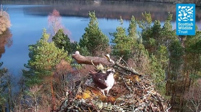
The remains are believed to be Osprey LM12, the famous resident male also known as Laddie.
Webcam footage from the Scottish Wildlife Trust’s Loch of the Lowes Reserve in Perthshire where Laddie returned this spring after over-wintering in Africa
The police haven’t yet revealed the cause of death but the fact they’ve issued an appeal for information suggests that there is at least a suspicion of criminality.
If a post mortem subsequently confirms the osprey was killed illegally, it will cause upset for thousands of people around the world who have followed this charismatic osprey’s story for years via the SWT webcam, and will once again bring international shame on Scotland for its continued failure to protect birds of prey.
UPDATE 20 May 2024: Update on death of Osprey ‘Laddie’ from Loch of the Lowes Reserve in Perthshire (here).
UPDATE 21 August 2024: Post mortem confirms osprey ‘Laddie’ died of natural causes (here)
SHOT PEREGRINE FOUND ON DOVE STONE NATURE RESERVE IN PEAK DISTRICT NATIONAL PARK
A shot Peregrine was found in early April on Dove Stone nature reserve, landowned by United Utilities and managed in partnership with the RSPB
Due to the severity of its injuries the Peregrine was euthanised
This is the latest incident in catalogue of raptor persecution incidents in the Peak District
The RSPB is appealing to the public for information relating to this incident
The RSPB has offered a £5,000 reward for information which leads to a successful conviction for this wildlife crime. This amount has been matched by the Peak District National Park Authority, taking the reward to £10,000.
The shot peregrine. Photo supplied by RSPB
On 4 April an adult female Peregrine was found on Dove Stone nature reserve north of Woodhead reservoir, near Crowden, in the Peak District National Park. The bird was taken to a local veterinary practice where they confirmed it had been shot and due to the extent of its injuries, it was euthanised. The incident was immediately reported to Derbyshire Police.
The grounded peregrine. Photo supplied by RSPB
X-rays showed shotgun pellets lodged in the elbow and shoulder of the bird’s left wing. An expert post-mortem also revealed a puncture wound in the bird’s chest caused by shotgun pellets and concluded that the bird was shot at or near the location it was found, as the injuries it sustained would have prevented it from flying.
X-ray showing shot gun pellets lodged in the peregrine’s body. Image supplied by RSPB
Although Peregrine populations are recovering in many lowland areas across the UK, breeding Peregrines are missing from some upland areas in England due to illegal persecution. The RSPB has recorded 182 confirmed incidents of Peregrine persecution across the UK from 2003 to 2022. Between 2018 and 2022 alone, 30 Peregrines were killed or injured in England, including 19 which were shot. Data shows that nationally a significant proportion of raptor persecution incidents are linked to land managed for gamebird shooting. In 2022 at least 64% of confirmed incidents of raptor persecution in the UK were associated with land managed for gamebird shooting.
Mark Thomas, RSPB Head of Investigations UK: “To think that this stunning bird was found shot at Dove Stone – a place which we help manage for the benefit and safety of species such as the Peregrine – is shocking.
“This is just the latest incident of raptor persecution in the Dark Peak, a notorious blackspot for birds of prey, where these species should naturally be thriving. If anyone has any information about this crime, please contact us or the police.”
Chief Executive of the Peak District National Park Authority, Phil Mulligan added: “It’s deeply concerning to see a species as iconic as the Peregrine shot within our National Park, and so much more distressing during the crucial breeding season for many of our birds of prey. This is therefore not just the loss of a single bird of prey, but impacting on a potential further generation when every one of these charismatic raptors counts.
“Our birds of prey of all shapes and sizes have a right to call the Peak District home without fear of falling victim to acts of wildlife crime. That’s why we have committed to supporting the reward for information in this case, and I would urge anyone to contact the police regarding this or other potential incidents that may be putting wildlife at risk.”
Chris Wilkinson, Derbyshire Police Rural Crime Team “It is a sad fact that bird of prey crime is still prevalent in Derbyshire and particularly concerning is that this incident appears to have occurred on an RSPB reserve. We are keen to speak with anyone who may have information about this crime”.
If you have any information, please call Derbyshire Police on 101 and quote crime reference number: 24000198336. Alternatively, you can call the RSPB anonymously on their dedicated Raptor Crime Hotline on 0300 999 0101.
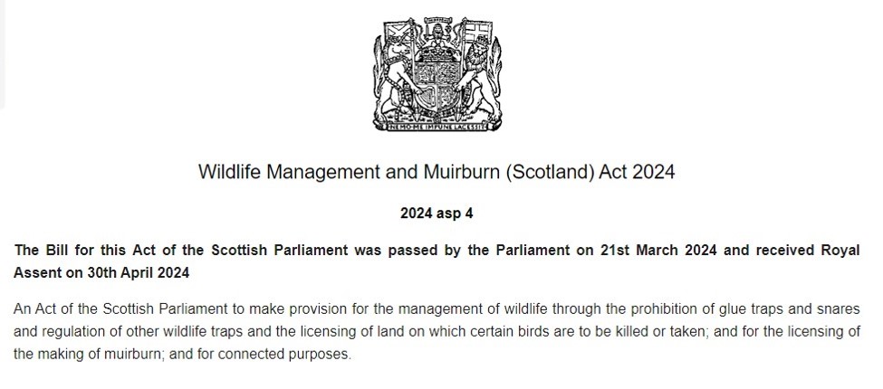
The Wildlife Management & Muirburn (Scotland) Bill, passed by the Scottish Parliament on 21 March 2024, has now become the Wildlife Management & Muirburn (Scotland) Act 2024 after receiving royal assent on 30th April.
The irony is not lost on me that all Bills, but this one in particular, still require royal assent before they become Acts. The idea that a grouse-moor-owning-crown-wearing-unelected bloke from the aristocracy, whose family influenced the popularity of driven grouse shooting many decades ago, is seen as the highest authority on whether grouse shooting should be licensed or not in response to ongoing, widespread criminality on, er, grouse moors, is laughable.
This particular grouse-moor-owning-crown-wearing-unelected bloke from the aristocracy needn’t worry too much about the effect of the new Act though. If you look at Part 3 31(1) of the Act you find this:
In other words, if Police Scotland have reason to suspect that a wildlife crime has been committed on one of the king’s private grouse moors (e.g. Delnadamph in the Cairngorms National Park) and they want to get a warrant to conduct a search of the estate for potential evidence, they can only exercise that warrant if they’ve been given prior consent by a person appointed by the king.
Genius. Can’t see any flaws in that whatsoever.
Now the Bill has become an Act, the final stage in this long, long process of licensing grouse shooting in Scotland in an attempt to stop the illegal persecution of birds of prey will be the development of the two Codes of Practice associated with the new Act, one for grouse moor management and one for muirburn. More details on the progress of those shortly…
Cast your mind back to November 2023 when Police Scotland issued an appeal for information about the suspicious disappearance of a satellite-tagged golden eagle in the Scottish Borders in October 2023, which Police said at the time they believed “has come to harm” (see here).
We later learned that this young golden eagle, called ‘Merrick’, was part of the South Scotland Golden Eagle Project, a lottery-funded conservation initiative which is translocating young golden eagles from various sites across Scotland to boost the tiny remnants of the golden eagle breeding population in south Scotland (see here).
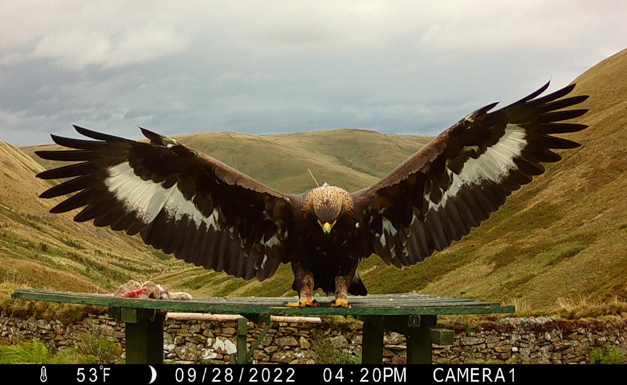
Camera trap photo of golden eagle Merrick, from South Scotland Golden Eagle Project
Recent research has demonstrated the need for these translocations as golden eagles from further north in Scotland rarely visit south Scotland of their own accord (see here) so without translocations the golden eagle population in south Scotland was at serious risk of extirpation, especially with the ongoing persecution of these local eagles (e.g. see here), despite the desperate denial of the Scottish Gamekeepers Association (see here).
Today there has been a further update about the police investigation into the disappearance of golden eagle Merrick, with a press release issued by the South Scotland Golden Eagle Project. It is revealed that Police Scotland believe Merrick was “shot and killed” whilst sleeping in a tree before “someone then removed her body and destroyed her satellite tag“.
I’m going to reproduce the press release below, but then I’m going to discuss what wasn’t said in the press release because I always find the omissions more interesting.
Bear in mind when you read this press release that it was constructed by all the project partners involved in the South Scotland Golden Eagle Project, including those from the grouse-shooting lobby, who, unsurprisingly, appear to have used it as a vehicle to pump out some gratuitous pro-grouse shooting material.
I’m told by other project partners that this press release has been argued over for months, presumably because some partners wanted to do a damage-limitation job on it. Kudos to the Project team though for at least getting something out and providing a good deal of transparency about the circumstances of this eagle’s disappearance.
Here’s the press release – all photos supplied by South Scotland Golden Eagle Project. My comments will follow underneath:
PERSECUTION SUSPECTED IN DISAPPEARANCE OF GOLDEN EAGLE MERRICK
Following an investigation by Police Scotland, representatives for a groundbreaking conservation initiative, which attributes its success to overwhelming support from the public, raptor workers and land managers, have today (Wednesday 1 May 2024) confirmed that they are confident Merrick the golden eagle’s disappearance is due to persecution.
Merrick (F43), a female golden eagle that the project team translocated to southern Scotland in 2022, was reported missing in autumn 2023. With permission from Police Scotland, further information about the circumstances of Merrick’s disappearance and the evidence left behind can now be revealed.
Sharing further details, Project Manager, Dr Cat Barlow said: “We can confirm that Police Scotland has found clear evidence that a wildlife crime has been committed. They are confident Merrick’s disappearance was due to persecution.
“The South of Scotland Golden Eagle Project is incredibly angry, upset and disappointed that her disappearance appears to have been at the hands of an individual or individuals who consider themselves above the law.
“The Project’s translocated eagles have captured the hearts and minds of all our supporters, from conservationists, and raptor workers to landowners and the wider community, including children, visitors and business operators, who all share in our utter shock and disappointment.
“However, this incident, and the staunch support we have had, makes us utterly determined to fight the persecution of golden eagles and continue our successful translocation work to reinstate a resilient population of golden eagles across southern Scotland.”
Chair of the South of Scotland Golden Eagle Project, Dumfriesshire farmer Michael Clarke added: “Whoever committed this deplorable wildlife crime should hang their heads in shame. Golden eagles are back to stay in the South of Scotland, and we very much hope they continue to spread from here to all parts of the UK.
“We thank everyone for their support at this tough time. We are grateful to Police Scotland for their support and using all the resources at their disposal to establish the full circumstances. We remain more determined than ever to establish a sustainable population of golden eagles in the South of Scotland.”
Merrick (F43) originated from Rottal Estate near Kirriemuir in the Angus Glens, a traditional sporting estate, which is accredited by Wildlife Estates Scotland (WES) for its commitment to protecting and restoring wildlife and biodiversity. Speaking about her disappearance, estate owner and Chair of Scottish Land & Estates (SLE) Dee Ward said: “We utterly condemn raptor persecution in the strongest possible terms and it is right and proper that anyone who commits such an act is prosecuted and convicted.
“Merrick is an eagle our own family estate donated to the project and we’re incredibly proud of the part we and many other estates, land managers and gamekeepers have played in the success of the South of Scotland Golden Eagle Project. Indeed, the project has otherwise been an incredible success built on respect and co-operation between keepers, farmers, foresters and raptor conservationists.
“This incident makes us all the more passionate about continuing that support and we will do all we can to prevent, detect and condemn anyone who thinks this kind of abhorrent behaviour is acceptable.”
Merrick was the fifth eagle collected in the summer of 2022, the last to leave the aviaries, and the heaviest eagle translocated that summer, at 5.2 kg. She was named after the highest peak in the Southern Uplands, by the South of Scotland Golden Eagle Project’s host charity, the Southern Uplands Partnership (SUP).
The project team has followed Merrick’s journey since her release using round-the-clock surveillance techniques, alongside reports of sightings from the Moorland Association and shooting estates across the country. She was thriving before her disappearance and exploring widely across the south of Scotland and Northern England. She was even photographed on a trip to Weardale and filmed in Nidderdale Area of Outstanding Natural Beauty.
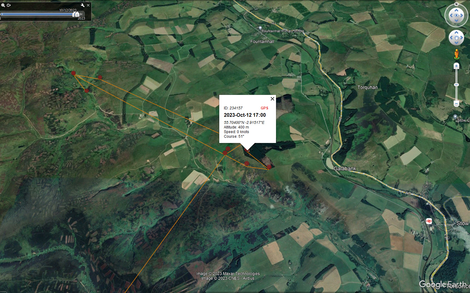
Each of the project’s eagles are fitted with a state-of-the-art satellite tag which transmits regular, reliable and accurate information about the birds’ wellbeing and movements. Until her disappearance, Merrick’s tag had been transmitting normally. During the eight days before her disappearance, she was exploring the Moorfoot Hills. Then on 12 October, her tag suddenly stopped transmitting, indicating “no malfunction”, which strongly suggested human interference.
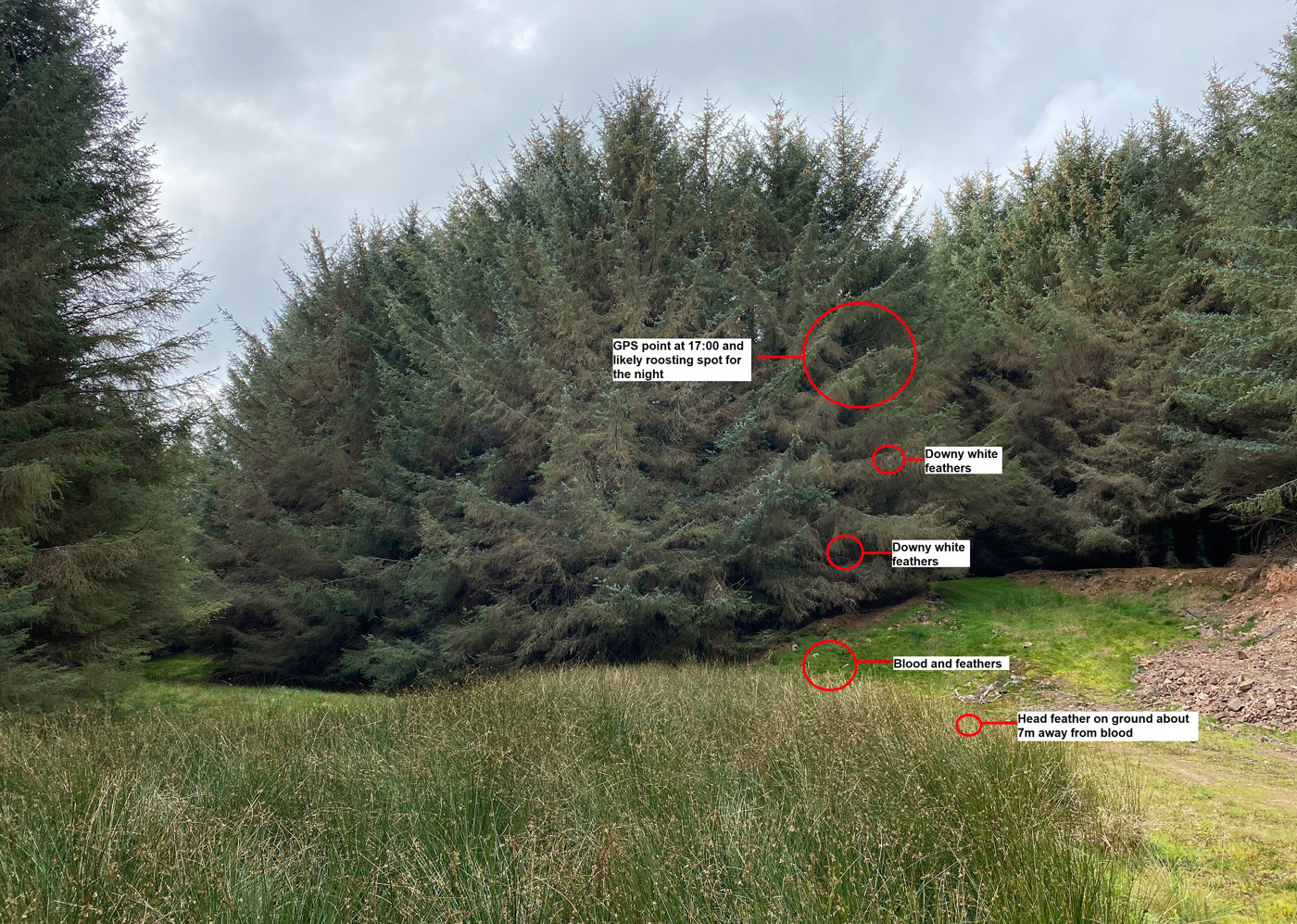
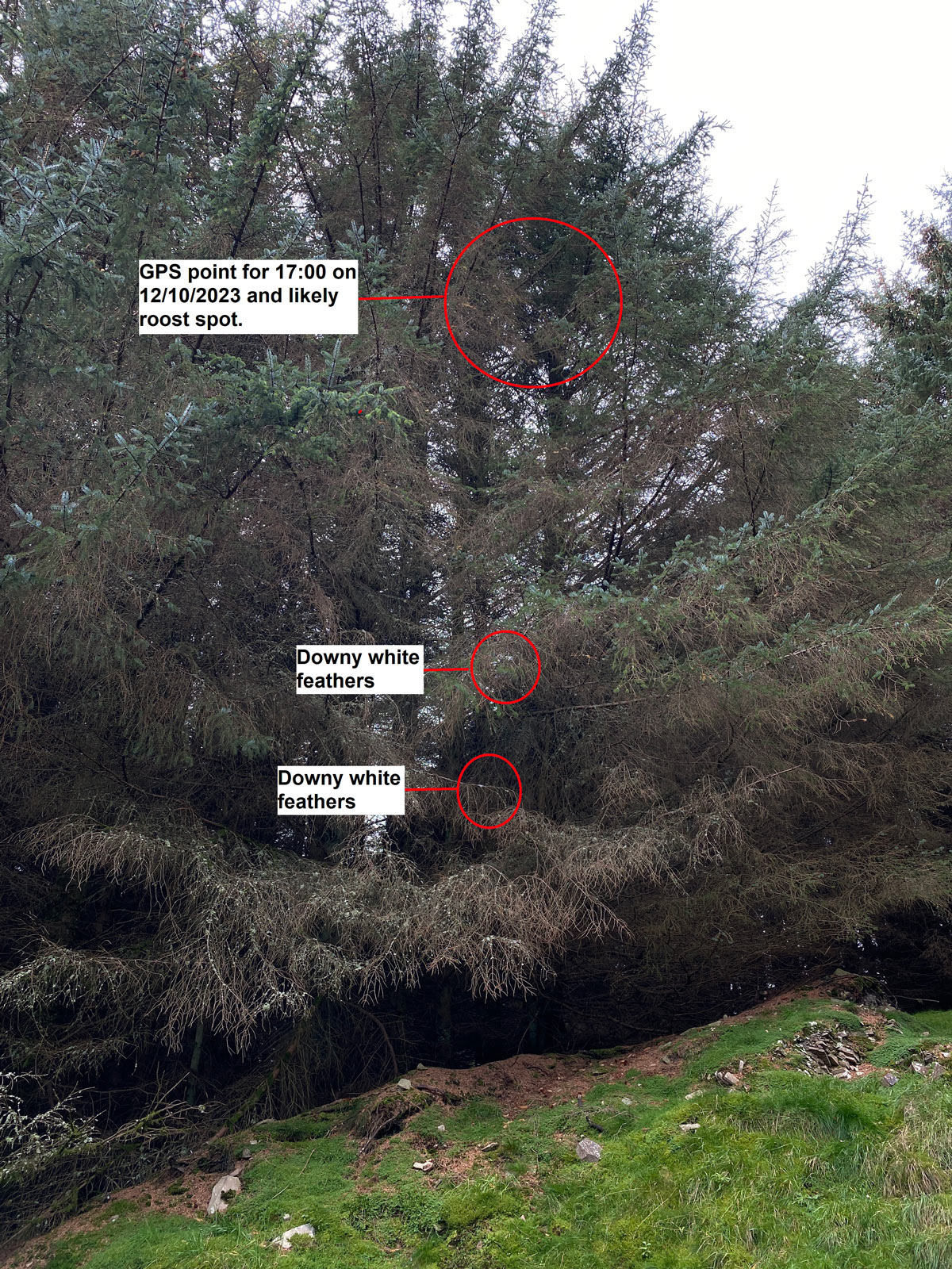
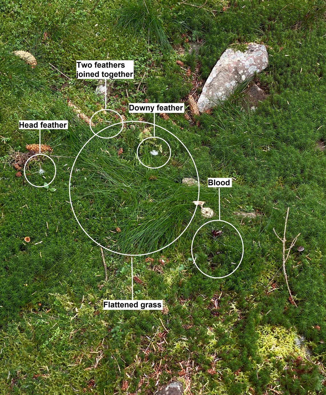
On a visit to check on a juvenile eagle in the area, Eagle Officer, John Wright, inspected the relatively bare branches of a Sitka Spruce, Merrick’s last known roosting spot. He very quickly noticed a small golden lanceolate shaped head feather, two small wing coverts and some white under-down laying on the moss directly below the tree. Recalling his visit to the site, John said: “I saw a film of blood stretched across the grass stems. It subsequently turned out that a considerable amount of blood was present in and below the moss layer. As I stood back from the feather and blood location, I could see small downy feathers scattered in the dense spruce foliage below the roosting branches.
“Merrick had been roosting (sleeping perched) in a tree when her tag stopped transmitting. Golden eagles, as apex predator, have very few natural predators and so fears that Merrick had been fatally injured whilst roosting were quickly dismissed. Police Scotland have told us that they are confident humans were involved in the demise of this eagle.”
The Project team contacted Police Scotland, who promptly reached the site before weather destroyed any evidence to investigate the incident. This allowed them to confidently eliminate most other potential causes of death or disappearance. The nature and pattern of feathers and blood, and all other evidence, indicated to the Police that Merrick was shot and killed.
Dr Cat Barlow said: “Looking at the evidence, Police Scotland believe she was shot then fell to the ground, where she bled considerably through a single wound. Police Scotland believe that someone then removed her body and destroyed her satellite tag.”
In November, Police Scotland issued a statement stating that they believed she had “come to harm” and were treating her disappearance as “suspicious.”
Detective Sergeant David Lynn, Police Scotland Wildlife Crime Coordinator, said: “Since the report was made, officers have been working with a range of partner agencies to establish more details and gather further information to establish the circumstances.
“The bird was last seen in the area to the west of Fountainhall, between Heriot and Stow on Thursday, 12 October. A full search of this area was carried out and officers believe the bird has come to harm and are treating its disappearance as suspicious.
“We are determined to protect these magnificent birds. We work closely with a number of partners to tackle wildlife crime, which can be challenging and complex to investigate. I urge anyone with any information to contact us through 101 quoting reference number 1193 of 18 October. Alternatively, please contact Crimestoppers though 0800 555 111, where anonymity can be maintained.”
The South of Scotland Golden Eagle Project partners the Southern Uplands Partnership, RSPB Scotland, Scottish Land & Estates, Scottish Forestry, GWCT and NatureScot all share in the bitter disappointment of today’s news.
Since the first chicks were released in 2018, the project has had significant success, quadrupling the local population of golden eagles to the highest number seen in the area for centuries. Survival rates of the translocated birds are 90%, which is incredibly high.
The translocated golden eagles regularly and safely visit upland areas, which are managed for shooting and are a natural habitat for the golden eagle. The project has had excellent support from shooting estates in the area, who have worked with the team in many ways to ensure golden eagles thrive in southern skies – from the provision of chicks to supporting the development of artificial eyries in a safe place on their land.
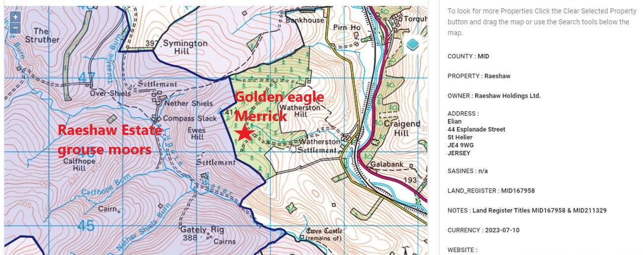
That last image is what I want to focus on. It shows the location of Merrick’s last known roost spot and where her blood and feathers were found.
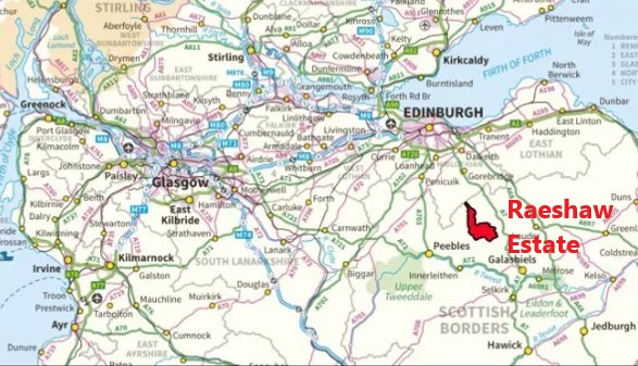
According to Andy Wightman’s fantastic Who Owns Scotland website (if you don’t already subscribe I recommend you do), this location is several metres from the boundary of Raeshaw Estate in the Moorfoot Hills.
RPUK map showing the boundary of Raeshaw Estate, derived from data on the Who OwnsScotland website
Screen grab from Who Owns Scotland website, annotated by RPUK, showing the proximity of Merrick’s last known location and the Raeshaw Estate (shaded in blue)
It struck me as odd that in the press release, although there are frequent references to how great ‘traditional sporting estates’ are for golden eagle conservation (and in the case of Rottal Estate where Merrick hatched, justifiably so), nobody seemed to want to mention the proximity of Merrick’s last known location and the discovery of her feathers and blood to the ‘traditional sporting estate’ known as Raeshaw. Why is that?
It would seem quite a significant piece of information to me, given that government-funded scientific research has identified a link between the proximity of some driven grouse moors and golden eagle persecution in Scotland. Not all driven grouse moors, but some.
Regular blog readers will recognise the name of Raeshaw Estate. I’ve blogged about it many times before as this was one of the first estates to be hit with a General Licence restriction back in 2015 based on ‘evidence provided by Police Scotland of wildlife crime against birds‘ although there was insufficient evidence to link the crimes to a named individual (see here), hence the GL restriction as opposed to a prosecution.
Raeshaw took NatureScot to court to challenge the decision under judicial review but lost the case after the court considered NatureScot’s decision to be lawful (here).
During the time Raeshaw was serving a General Licence restriction, employees applied for an individual licence to permit the continued (lawful) killing of so-called ‘pest’ birds on the estate (e.g. 1,000 birds reported killed under one of these licences, see here), but then even the individual licence was later revoked after NatureScot found ‘multiple instances of breaches of conditions of an individual licence that had been granted to cover essential management activities‘ (see here).
NatureScot also said, ‘These breaches may also constitute offences under the Wildlife and Countryside Act, so SNH has reported the details to Police Scotland‘. I’m not aware of any subsequent prosecution in relation to those alleged offences.
It’s worth pointing out here that as far as I’m aware, nobody from the Raeshaw Estate has ever been prosecuted for any of the alleged wildlife crimes reported from this area.
It’s also worth pointing out that, just because Merrick’s last known location and the discovery of her blood and feathers was just several metres from Raeshaw Estate’s boundary, that doesn’t mean we can automatically assume that anyone associated with Raeshaw Estate was involved. There’s no direct evidence to demonstrate a link. Indeed, I heard on the grapevine that Police Scotland was refused permission to obtain a search warrant because the Crown Office didn’t consider there was sufficient evidence to justify it.
According to Andy Wightman’s research, Raeshaw Estate is owned by an overseas entity called Raeshaw Holdings Ltd, which according to Companies House is registered in the tax haven of Jersey (here). Last year it was reported that the beneficial owner of Raeshaw was billionaire Tory donor Louis Moore Bacon.
The sporting elements of the estate are managed by one of ‘grouse moor guru’ Mark Osborne’s companies, a sporting agency called ‘JM Osborne Rural and Sporting‘. Members of the grouse shooting industry, who you’ll recall routinely profess to have a zero tolerance policy towards raptor persecution, even in the press release above, clearly do not consider there to be any link with the apparent shooting and killing of Merrick and anyone employed on Raeshaw Estate. If they did, various gamekeeping organisations such as the Scottish Gamekeepers Association, National Gamekeepers Organisation, Southern Uplands Moorland Group and the Angus Glens Moorland Group wouldn’t this week be promoting on social media the latest gamekeeper vacancy on what is described as the ‘prestigious’ and ‘cracking’ Raeshaw Estate:
Screen grab from the Scottish Gamekeepers Association’s Facebook page, 30 April 2024
Screen grab from the National Gamekeepers Organisation’s Facebook page, 29 April 2024
Screen grab from the Facebook pages of gamekeeping organisations the Angus Glens Moorland Group & Southern Uplands Moorland Group, 29 April 2024
And grouse moor lobby group Scottish Land & Estates certainly wouldn’t be providing regular, full page advertising space in its quarterly LandBusiness magazine to any of Mr Osborne’s companies (JM Osborne Rural & Sporting and his gun-making company William Powell) if it considered there was any link:
Screen grab from SLE’s LandBusiness Magazine, Autumn 2022
Screen grab from SLE’s LandBusiness Magazine, Spring 2024
And pro-game shooting charity Game and Wildlife Conservation Trust (GWCT) certainly wouldn’t be accepting generous raffle prizes worth a value of tens of thousands of pounds from any company even suspected of having a link to raptor persecution – see here and:
Screen grab from GWCT website
And surely neither would the British Association for Shooting & Conservation (BASC) be accepting generous raffle prizes worth £13,000:
Screen grab from BASC website
To summarise then:
Golden eagle Merrick, like so many satellite-tagged golden eagles before her, ‘disappeared’ in suspicious circumstances in October 2023.
Some of her feathers were found next to pools of her blood at her last known roost site.
Police Scotland believe she was ‘shot and killed’.
Although this incident took place in close proximity to the boundary of Raeshaw Estate, there is no suggestion whatsoever that anyone there was involved.
Police Scotland found no evidence to allow them to arrest and charge anyone in connection with Merrick’s disappearance or death.
UPDATE 10 Feb 2026: Three-year General Licence restriction imposed on Raeshaw Estate (again), this time relating to shooting of Golden Eagle Merrick (here)
UPDATE 7 April 2026: Raeshaw Estate loses appeal against 3-year General Licence restriction in relation to Golden Eagle Merrick being ‘shot & killed’ (here)
UPDATE 11 Aug 2026: Raeshaw Estate seeks judicial review of General Licence restriction relating to Golden Eagle Merrick being ‘shot & killed’ (here)
The case against Ruabon Moor gamekeeper Stuart Hart has been discontinued.
Hart, 47, had faced two charges – Using a trap to kill or take a wild bird (in this case, a Goshawk) and possession of an article capable of being used to commit a summary offence (see here and here for earlier blogs).
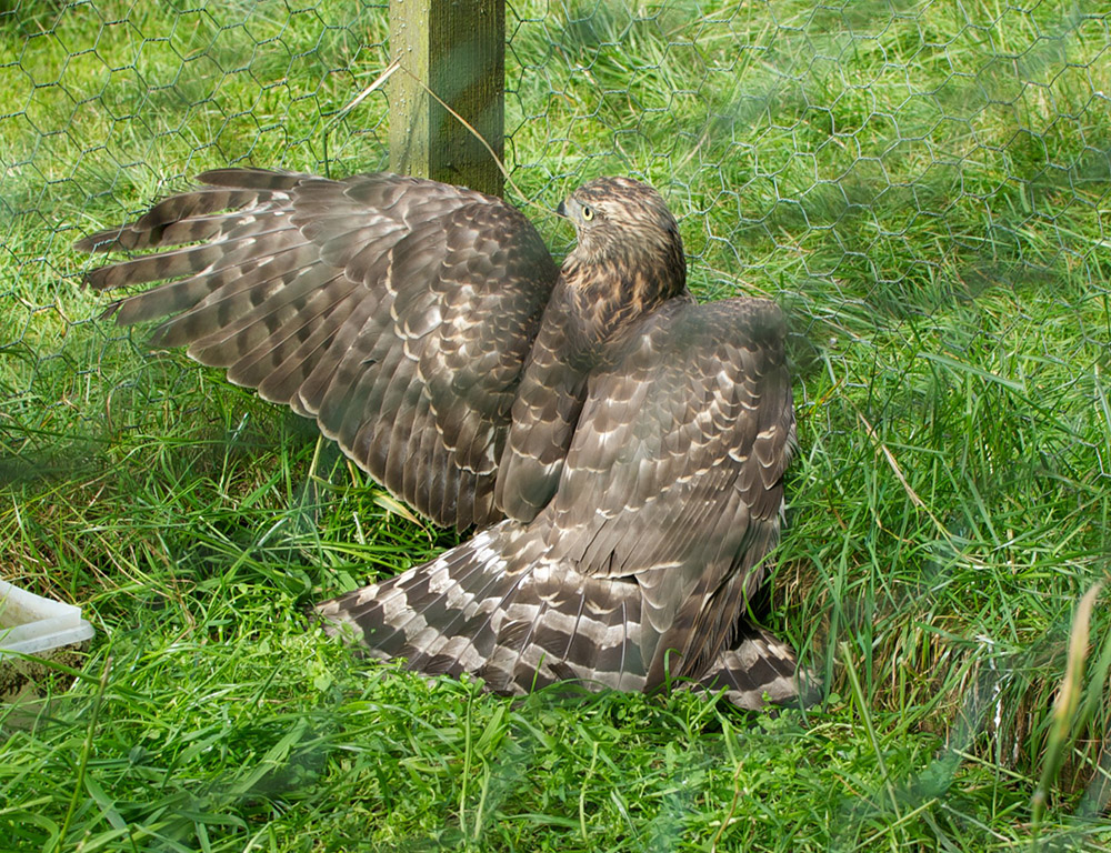
Young goshawk in a cage trap. Photo by RSPB (file photo, not linked to this case)
The first hearing in this case was held at Wrexham Magistrates on 28 March 2024. Hart had not entered a plea as his defence solicitor told the court he considered there had been procedural errors in the way the case had been brought. He also told the court that he wanted to challenge the admissibility of the RSPB’s video evidence (here).
The case was adjourned and was due to be heard again today (30 April 2024). However, according to the court, the case has now been discontinued.
Interesting. More to come on this…
UPDATE 26 November 2024: Ruabon Moor gamekeeper prosecution – why the case was discontinued (here)
A new scientific research paper published yesterday suggests that prescribed burning, including muirburn on grouse moors, continues to ‘fall short of sustainable practices’.
The research was authored by scientists at the RSPB and was published in the peer-reviewed journal Remote Sensing in Ecology and Conservation:
Annual extent of prescribed burning on moorland in Great Britain and overlap with ecosystem services (Shewring et al. 2024).
The paper presents an assessment of the annual extent of prescribed burning occurring on moorland in Great Britain (2017-2022) and further assesses the overlap of burning with key upland ecosystem services. Using high resolution satellite images of the GB uplands for five consecutive burning seasons, the authors developed a semi-automated method to detect and map the new burn scars in moorland vegetation.
This new method has enabled a more rapid assessment of the annual amount of burning that occurred across the GB uplands over five burning seasons (2017/18 to 2021/22) and further allowed researchers to look at where burning is coincident with known fire-sensitive features (e.g. peat soils, protected areas, steep ground and alpine habitats).
The study detected burning in many protected areas, with those in the North of England, and especially the North York Moors SAC/ SPA, subject to the highest percentage area burned.
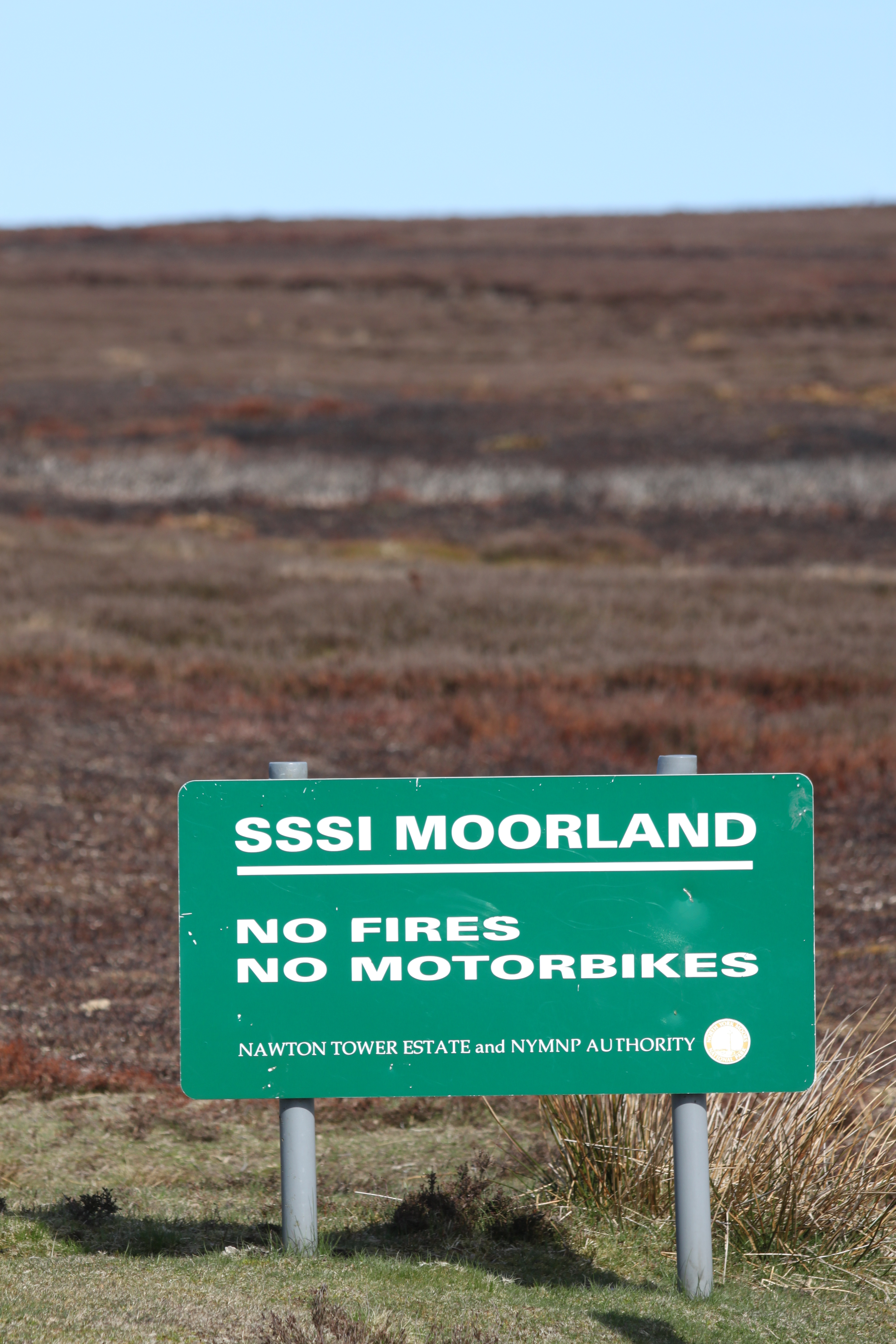
Evidence of burning on a grouse moor in the North York Moors National Park. Photo: Ruth Tingay
Over these five burning seasons, an average of 15,250 ha of vegetation was burnt each year (59% of GB burned area was in Scotland with 39% in England).
In England, the area mapped as burnt during the 2021/22 burning season dropped to 1,859 ha, a decline of 73% when compared with the average of the four previous burning seasons – a pattern not repeated for Scotland.
The decline in the overall area burnt in England during the 2021/22 burning season is coincident with the new Heather and Grass etc Burning (England) Regulations that came into force in May 2021. Researchers will now use the method to map the extent of burning for the last two burning seasons in England to see if the decline has continued.
I’m sure it’ll also come in handy for monitoring the forthcoming adherence to the new regulations under the Wildlife Management & Muirburn (Scotland) Act. It’s easy to hide away evidence of illegal raptor persecution – not so easy to hide evidence of illegal muirburn.
Clearly any decline in burning on sensitive features like peatlands is welcome. However, despite the decline in the area burnt in England during the 2021/22 burning season, the study still found that 41% of the area mapped as burnt was on deep peat. These findings are consistent with the reports of burning the RSPB receive via its burning app, with one-third of reports received apparently of fires on deep peat.
Last year, two grouse moor owners were convicted for burning on deep peat in protected areas, one in the Peak District (here) and one in Nidderdale; embarrassingly, that estate was owned by a Board member of the Moorland Association (here).
For further summary information about this latest research I’d recommend this blog written by the lead author Mike Shewring, and this blog by co-author Pat Thompson.
The British Trust for Ornithology (BTO) is advertising for a Scottish Raptor Monitoring Officer to support the well-established Scottish Raptor Monitoring Scheme (SRMS).
This is a part-time position (3 days per week) on a fixed two-year contract. Salary: £25,110 per annum + 11% employer pension contribution.
The Scottish Raptor Monitoring Scheme is seeking a people-person who is keen to share their passion for raptors and raptor monitoring, to take a coordinating role within the Scheme on behalf of all its partners and keep SRMS data contributors informed and engaged with our work. The successful candidate will promote, organise and deliver both face-to-face and online training, which may include raptor monitoring survey techniques and online data entry to existing and new audiences. They will be responsible for continuing to build and nurture a community of engaged and motivated volunteers delivering data to inform the conservation of Scottish raptors.
The League is looking to fill this role quickly and will be reviewing applications on a rolling basis. To apply, submit your CV and a covering letter to people@league.org.uk