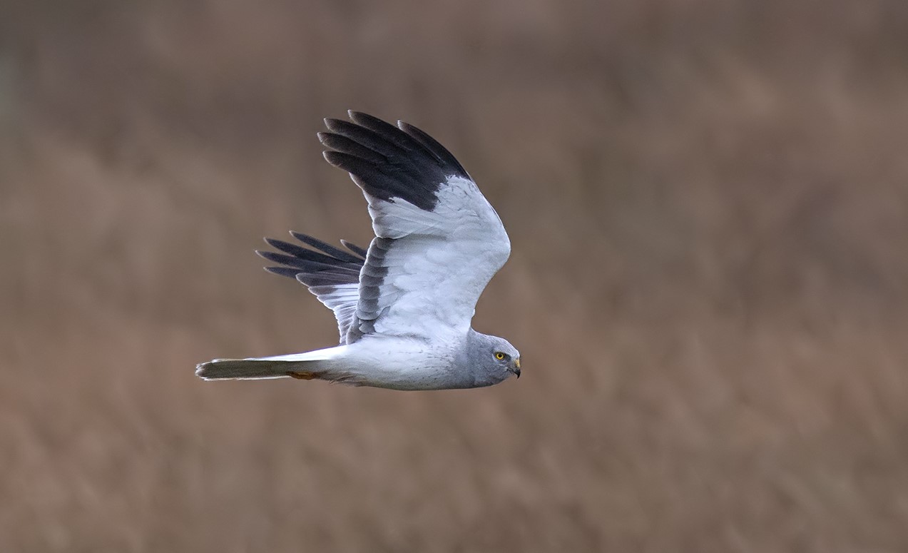
Further to this morning’s blog (here), gamekeeper Racster Dingwall, 34, appeared at Skipton Magistrates’ Court this afternoon where he pleaded not guilty to two charges relating to an alleged conspiracy to kill a Hen Harrier on a grouse moor (Coniston & Grassington Estate) in the Yorkshire Dales National Park on 2nd October 2024.
This case relates to the covert footage filmed by the RSPB’s Investigations team last autumn and later shown on Channel 4 News (here).
As Dingwall has pleaded not guilty the case will now move towards a trial.
A pre-trial hearing has been scheduled for 9th September 2025 at York Magistrates’ Court for legal discussion about the admissibility of the video and audio footage.
Keep an eye on Channel 4 News this evening…
NB: Comments are closed until criminal proceedings have concluded.
UPDATE 4 May 2025: News coverage about first court appearance of Yorkshire Dales gamekeeper Racster Dingwall in relation to alleged conspiracy to shoot a Hen Harrier (here)
UPDATE 9 September 2025: Gamekeeper Racster Dingwall back in court today for case relating to Hen Harrier shooting on a grouse moor in Yorkshire Dales National Park (here)
UPDATE 9 September 2025: Judge rules RSPB covert video surveillance is admissible evidence in prosecution of gamekeeper Racster Dingwall (here)
UPDATE 25 September 2025: More detail on court ruling accepting admissibility of RSPB’s covert surveillance in prosecution of gamekeeper accused of conspiracy to kill a Hen Harrier (here)
A gamekeeper is due to appear at Skipton Magistrates’ Court this morning to face a charge under the Serious Crime Act in relation to the alleged shooting of a hen harrier in October 2024 on the Coniston and Grassington Estate in the Yorkshire Dales National Park.
The allegation and subsequent charge is a result of covert footage filmed by the RSPB’s Investigations Team that was featured on Channel 4 News (here).
NB: As this case is live, comments are disabled on this blog until criminal proceedings have ended to avoid prejudicing the case.
UPDATE 2 May 2025: Gamekeeper Racster Dingwall pleads not guilty to two charges relating to alleged conspiracy to kill a Hen Harrier on grouse moor in Yorkshire Dales National Park (here)
Last month Natural England announced that it had made a (very sensible) decision not to issue a Hen Harrier brood meddling licence to the Moorland Association in 2025 (see here).
This announcement came a few weeks after Natural England’s announcement that the seven-year Hen Harrier brood meddling trial had now ended (see here).
For new blog readers, the Hen Harrier brood meddling trial was a conservation sham sanctioned by DEFRA as part of its ludicrous ‘Hen Harrier Action Plan‘ and carried out by Natural England between 2018 – 2024, in cahoots with the grouse shooting industry, the very industry responsible for the species’ catastrophic decline in England. In general terms, the plan involved the removal of Hen Harrier chicks from grouse moors, they were reared in captivity, then released back into the uplands just in time for the start of the grouse-shooting season where many were illegally killed. It was plainly bonkers. For more background see here and here.
The RSPB has long objected to Hen Harrier brood meddling, and even took, along with Mark Avery, a legal challenge against the brood meddling trial in 2018 (here) but unfortunately this was unsuccessful.
The RSPB has now responded to Natural England’s decision not to issue a Hen Harrier brood meddling licence in 2025 and has expressed its ‘relief’ at the decision, given the ongoing illegal persecution of this species by gamekeepers on UK grouse moors. The RSPB remains concerned about the potential for a future brood meddling licence.
In July 2024 Joe Morris, 28, of White Grove, Colne, Lancashire was charged with killing two wild birds with an air rifle after police received reports of someone seen dumping a Tawny Owl and a Woodpigeon in a wheelie bin in Colne in March 2024 (see here).
This case was heard in November 2024 but it missed my radar so here, for completeness, is a belated report, thanks to the court reporter Andrew Bellard at the Lancashire Telegraph who wrote the following article, published 18 November 2024:
DRUNK MAN SHOT TAWNY OWL AND WOOD PIGEON AT ALKINCOATS PARK
A drunk man shot two “beautiful” birds with an air rifle when he went shooting in a public park.
Blackburn magistrates heard Joe Morris was drunk when he went to the park and shot a tawny owl and a wood pigeon.
Morris, 28, of White Grove, Colne, pleaded guilty to possessing an air weapon in Alkincoats Park, Colne, and killing a tawny owl and a wood pigeon.
He was made subject to a community order for 12 months with a 15-day rehabilitation activity requirement and a six-month alcohol treatment requirement.
He was fined £40 with £85 costs and a £114 victim surcharge.
District Judge Alexandra Preston said wildlife was priceless and Morris had killed two beautiful birds.
“It is alarming to think you were out with an air rifle and, by your own admission, you were drunk when you did this,” she said.
Henry Prescott, prosecuting, said police received an anonymous tip-off about a man returning to his home address and putting a tawny owl and a wood pigeon in his wheelie bin.
The caller said Morris regularly went to Alkincoats Park shooting wild birds.
When officers spoke to Morris at his home he admitted what he had done and recovered the birds from the bin.
Mr Prescott said the air rifle was not an illegal weapon and had not been seized by the police.
Mark Williams, defending, said his client had disposed of the air rifle and had no intention of replacing it.
“He is very embarrassed and ashamed of what he did,” said Mr Williams.
“He can’t and doesn’t wish to put forward any excuses. He accepts what he did was very inappropriate.”
Mr Williams said his client had problems with alcohol and had self-referred to Inspire.
For anyone who still wants to pretend that the grouse shooting industry isn’t responsible for the systematic extermination of hen harriers on grouse moors across the UK, here’s the latest catalogue of crime that suggests otherwise.
This male hen harrier died in 2019 after his leg was almost severed in an illegally set trap that had been placed next to his nest on a Scottish grouse moor (see here). Photo by Ruth Tingay
This is the blog I now publish after every reported killing or suspicious disappearance.
“They disappear in the same way political dissidents in authoritarian dictatorships have disappeared” (Stephen Barlow, 22 January 2021).
Today the list has been updated to include the most recently reported victims, four female hen harriers (Dina, R3-F2-22, Bonnie, and Gill) who vanished at various locations between January and April 2025 (here).
I’ve been compiling this list only since 2018 because that is the year that the grouse shooting industry ‘leaders’ would have us believe that the criminal persecution of hen harriers had stopped and that these birds were being welcomed back on to the UK’s grouse moors (see here).
This assertion was made shortly before the publication of a devastating new scientific paper that demonstrated that 72% of satellite-tagged hen harriers were confirmed or considered likely to have been illegally killed, and this was ten times more likely to occur over areas of land managed for grouse shooting relative to other land uses (see here). A further scientific paper published in 2023 by scientists at the RSPB, utilising even more recent data, echoed these results – see here.
2018 was also the year that Natural England issued a licence to begin a hen harrier brood meddling trial on grouse moors in northern England. For new blog readers, hen harrier brood meddling was a conservation sham sanctioned by DEFRA as part of its ludicrous ‘Hen Harrier Action Plan‘ and carried out by Natural England (NE), in cahoots with the very industry responsible for the species’ catastrophic decline in England.
For more background see here and for a critical evaluation of the trial after 5 years see this report by Wild Justice. In 2024 the brood meddling trial appeared to collapse for reasons which are not yet clear (see here) and the licence for the so-called ‘scientific trial’ expired. In March 2025 Natural England announced the end of the brood meddling trial (here) and in April 2025 announced that a licence application to continue brood meddling, submitted by the Moorland Association, had been refused (here).
Brood meddling was earlier described as a sort of ‘gentleman’s agreement’ by commentator Stephen Welch:
“I don’t get it, I thought the idea of that scheme was some kind of trade off – a gentleman’s agreement that the birds would be left in peace if they were moved from grouse moors at a certain density. It seems that one party is not keeping their side of the bargain“.
With at least 138 hen harriers gone since 2018, and 31 of those being brood meddled birds, there is no question that the grouse shooting industry was simply taking the piss. Meanwhile, Natural England pretended that ‘partnership working’ was the way to go and consecutive Tory DEFRA Ministers remained silent for all those years.
*n/a – no hen harriers were brood meddled in 2018. **Post mortem reports on a further seven hen harriers found dead in 2024/2025 are awaited. Those seven individuals are not included in this table.
‘Partnership working’ according to Natural England appeared to include authorising the removal of hen harrier chicks from a grouse moor already under investigation by the police for suspected raptor persecution (here) and accepting a £75k ‘donation’ from representatives of the grouse shooting industry with a contract clause that prevented Natural England from criticising them or the sham brood meddling trial (see here). This was in addition to a further £10k ‘donation’ that Natural England accepted, under the same terms, in 2021 (here).
Thankfully, the Scottish Government finally decided to act by introducing a grouse moor licensing scheme under the Wildlife Management & Muirburn (Scotland) Act 2024. The intention behind this new legislation is that grouse shooting estates could have their licences suspended/revoked if, on the balance of probability, it is shown that any raptor persecution crimes (& some other associated offences) are linked with grouse moor management on that estate. There, are, however, ongoing issues with the licence as it’s been significantly watered-down after an intervention from the grouse shooting industry (see here). Work is underway to address this.
In England a new Hen Harrier Taskforce was established in 2024, led by the National Wildlife Crime Unit, to use innovative techniques to target hen harrier persecution hotspots (locations where hen harriers repeatedly ‘disappear’ or are found illegally killed). It’s too early to judge the Taskforce’s success/failure and it’s been met with considerable resistance from the Moorland Association, the grouse moor owners’ lobby group (e.g. see here). So far though, it’s quite clear that the the illegal killing continues.
So here’s the latest gruesome list of ‘missing’/illegally killed hen harriers since 2018. Note that the majority of these birds (but not all) were fitted with satellite tags. How many more [untagged] harriers have been killed? We now have evidence that gamekeepers are specifically targeting untagged hen harriers, precisely to avoid detection (see here for extraordinary footage/audio by the RSPB’s Investigations Team as featured on Channel 4 News in October 2024).
February 2018: Hen harrier Saorsa ‘disappeared’ in the Angus Glens in Scotland (here). The Scottish Gamekeepers Association later published wholly inaccurate information claiming the bird had been re-sighted. The RSPB dismissed this as “completely false” (here).
5 February 2018: Hen harrier Marc ‘disappeared’ on a grouse moor in Durham (here).
9 February 2018: Hen harrier Aalin ‘disappeared’ on a grouse moor in Wales (here).
March 2018: Hen harrier Blue ‘disappeared’ in the Lake District National Park (here).
March 2018: Hen harrier Finn ‘disappeared’ near Moffat in Scotland (here).
18 April 2018: Hen harrier Lia ‘disappeared’ in Wales and her corpse was retrieved in a field in May 2018. Cause of death was unconfirmed but police treating death as suspicious (here).
8 August 2018: Hen harrier Hilma ‘disappeared’ on a grouse moor in Northumberland (here).
16 August 2018: Hen harrier Athena ‘disappeared’ on a grouse moor in Scotland (here).
26 August 2018: Hen Harrier Octavia ‘disappeared’ on a grouse moor in the Peak District National Park (here).
29 August 2018: Hen harrier Margot ‘disappeared’ on a grouse moor in Scotland (here).
29 August 2018: Hen Harrier Heulwen ‘disappeared’ on a grouse moor in Wales (here).
3 September 2018: Hen harrier Stelmaria ‘disappeared’ on a grouse moor in Scotland (here).
24 September 2018: Hen harrier Heather ‘disappeared’ on a grouse moor in Scotland (here).
2 October 2018: Hen harrier Mabel ‘disappeared’ on a grouse moor on the edge of the Yorkshire Dales National Park (here).
3 October 2018: Hen Harrier Thor ‘disappeared’ next to a grouse moor in Bowland, Lanacashire (here).
23 October 2018: Hen harrier Tom ‘disappeared’ in South Wales (here).
26 October 2018: Hen harrier Arthur ‘disappeared’ on a grouse moor in the North York Moors National Park (here).
1 November 2018: Hen harrier Barney ‘disappeared’ on Bodmin Moor (here).
10 November 2018: Hen harrier Rannoch ‘disappeared’ on a grouse moor in Scotland (here). Her corpse was found nearby in May 2019 – she’d been killed in an illegally-set spring trap (here).
14 November 2018: Hen harrier River ‘disappeared’ on a grouse moor in the Nidderdale AONB (here). Her corpse was found nearby in April 2019 – she’d been illegally shot (here).
16 January 2019: Hen harrier Vulcan ‘disappeared’ in Wiltshire close to Natural England’s proposed reintroduction site (here).
28 January 2019: Hen harrier DeeCee ‘disappeared’ in Glen Esk, a grouse moor area of the Angus Glens (see here).
7 February 2019: Hen harrier Skylar ‘disappeared’ next to a grouse moor in South Lanarkshire (here).
22 April 2019: Hen harrier Marci ‘disappeared’ on a grouse moor in the Cairngorms National Park (here).
26 April 2019: Hen harrier Rain ‘disappeared’ on a grouse moor in Nairnshire (here).
11 May 2019: An untagged male hen harrier was caught in an illegally-set trap next to his nest on a grouse moor in South Lanarkshire. He didn’t survive (here).
7 June 2019: An untagged hen harrier was found dead on a grouse moor in Scotland. A post mortem stated the bird had died as a result of ‘penetrating trauma’ injuries and that this bird had previously been shot (here).
5 September 2019: Wildland Hen Harrier 1 ‘disappeared’ on a grouse moor nr Dalnaspidal on the edge of the Cairngorms National Park (here).
11 September 2019: Hen harrier Romario ‘disappeared’ on a grouse moor in the Cairngorms National Park (here).
14 September 2019: Hen harrier (Brood meddled in 2019, #183704) ‘disappeared’ in the North Pennines (here).
23 September 2019: Hen harrier (Brood meddled in 2019, #55149) ‘disappeared’ in North Pennines (here).
24 September 2019: Wildland Hen Harrier 2 ‘disappeared’ on a grouse moor at Invercauld in the Cairngorms National Park (here).
24 September 2019: Hen harrier Bronwyn ‘disappeared’ near a grouse moor in North Wales (here).
10 October 2019: Hen harrier Ada ‘disappeared’ on a grouse moor in the North Pennines AONB (here).
12 October 2019: Hen harrier Thistle ‘disappeared’ on a grouse moor in Sutherland (here).
18 October 2019: Member of the public reports the witnessed shooting of an untagged male hen harrier on White Syke Hill in North Yorkshire (here).
November 2019: Hen harrier Mary found illegally poisoned on a pheasant shoot in Ireland (here).
November 2019: Hen harrier Artemis ‘disappeared’ near Long Formacus in south Scotland (RSPB pers comm).
14 December 2019: Hen harrier Oscar ‘disappeared’ in Eskdalemuir, south Scotland (here).
December 2019: Hen harrier Ingmar ‘disappeared’ in the Strathbraan grouse moor area of Perthshire (RSPB pers comm).
27 January 2020: Members of the public report the witnessed shooting of a male hen harrier on Threshfield Moor in the Yorkshire Dales National Park (here).
23 March 2020: Hen harrier Rosie ‘disappeared’ at an undisclosed roost site in Northumberland (here).
1 April 2020: Hen harrier (Brood meddled in 2019, #183703) ‘disappeared’ in unnamed location, tag intermittent (here).
5 April 2020: Hen harrier Hoolie ‘disappeared’ on a grouse moor in the Cairngorms National Park (here)
8 April 2020: Hen harrier Marlin ‘disappeared’ on a grouse moor in the Cairngorms National Park (here).
19 May 2020: Hen harrier Fingal ‘disappeared’ on a grouse moor in the Lowther Hills, Scotland (here).
21 May 2020: Hen harrier (Brood meddled in 2019, #183701) ‘disappeared’ on a grouse moor in Cumbria shortly after returning from wintering in France (here).
27 May 2020: Hen harrier Silver ‘disappeared’ on a grouse moor on Leadhills Estate, Scotland (here).
2020: day/month unknown: Unnamed male hen harrier breeding on RSPB Geltsdale Reserve, Cumbria ‘disappeared’ while away hunting (here).
9 July 2020: Unnamed female hen harrier (#201118) ‘disappeared’ from an undisclosed site in Northumberland (here).
25 July 2020: Hen harrier Harriet ‘disappeared’ on a grouse moor in the Yorkshire Dales National Park (here).
14 August 2020: Hen harrier Solo ‘disappeared’ in confidential nest area in Lancashire (here).
7 September 2020: Hen harrier Dryad ‘disappeared’ on a grouse moor in the Yorkshire Dales National Park (here).
16 September 2020: Hen harrier Fortune ‘disappeared’ from an undisclosed roost site in Northumberland (here).
19 September 2020: Hen harrier Harold ‘disappeared’ on a grouse moor in the Yorkshire Dales National Park (here).
20 September 2020: Hen harrier (Brood meddled in 2020, #55152) ‘disappeared’ next to a grouse moor in North Yorkshire (here).
24 February 2021: Hen harrier Tarras ‘disappeared’ next to a grouse moor in Northumberland (here)
12th April 2021: Hen harrier Yarrow ‘disappeared’ near Stockton, County Durham (here).
18 May 2021: Adult male hen harrier ‘disappeared’ from its breeding attempt on RSPB Geltsdale Reserve, Cumbria whilst away hunting (here).
18 May 2021: Another adult male hen harrier ‘disappeared’ from its breeding attempt on RSPB Geltsdale Reserve, Cumbria whilst away hunting (here).
24 July 2021: Hen harrier Asta ‘disappeared’ at a ‘confidential site’ in the North Pennines (here). We learned 18 months later that her wings had been ripped off so her tag could be fitted to a crow in an attempt to cover up her death (here).
14th August 2021: Hen harrier Josephine ‘disappeared’ at a ‘confidential site’ in Northumberland (here).
17 September 2021: Hen harrier Reiver ‘disappeared’ in a grouse moor dominated region of Northumberland (here)
24 September 2021: Hen harrier (Brood meddled in 2021, R2-F-1-21) ‘disappeared’ in Northumberland (here).
15 November 2021: Hen harrier (brood meddled in 2020, #R2-F1-20) ‘disappeared’ at the edge of a grouse moor on Arkengarthdale Estate in the Yorkshire Dales National Park (here).
19 November 2021: Hen harrier Val ‘disappeared’ in the Lake District National Park in Cumbria (here).
19 November 2021: Hen harrier Percy ‘disappeared’ in Lothian, Scotland (here).
12 December 2021: Hen harrier Jasmine ‘disappeared’ on a grouse moor (High Rigg Moor on the Middlesmoor Estate) in the Nidderdale AONB in North Yorkshire (here).
9 January 2022: Hen harrier Ethel ‘disappeared’ in Northumberland (here).
26 January 2022: Hen harrier Amelia ‘disappeared’ in Bowland (here).
10 February 2022: An unnamed satellite-tagged hen harrier ‘disappeared’ in a grouse moor dominated area of the Peak District National Park (here). One year later it was revealed that the satellite tag/harness of this young male called ‘Anu’ had been deliberately cut off (see here).
12 April 2022: Hen harrier ‘Free’ (Tag ID 201121) ‘disappeared’ at a ‘confidential site’ in Cumbria (here). It later emerged he hadn’t disappeared, but his mutilated corpse was found on moorland in the Yorkshire Dales National Park. A post mortem revealed the cause of death was having his head twisted and pulled off. One leg had also been torn off whilst he was still alive (here).
April 2022: Hen harrier ‘Pegasus’ (tagged by the RSPB) ‘disappeared’ on a grouse moor at Birkdale in the Yorkshire Dales National Park (here).
May 2022: A male breeding hen harrier ‘disappeared’ from a National Trust-owned grouse moor in the Peak District National Park (here).
May 2022: Another breeding male hen harrier ‘disappeared’ from a National Trust-owned grouse moor in the Peak District National Park (here).
14 May 2022: Hen harrier ‘Harvey’ (Tag ID 213844) ‘disappeared’ from a ‘confidential site’ in the North Pennines (here).
20 June 2022: Hen harrier chick #1 stamped to death in nest on a grouse moor in the Yorkshire Dales National Park (here).
20 June 2022: Hen harrier chick #2 stamped to death in nest on a grouse moor in the Yorkshire Dales National Park (here).
20 June 2022: Hen harrier chick #3 stamped to death in nest on a grouse moor in the Yorkshire Dales National Park (here).
20 June 2022: Hen harrier chick #4 stamped to death in nest on a grouse moor in the Yorkshire Dales National Park (here).
17 August 2022: Hen harrier (brood meddled in 2022, #R1-M1-22) ‘disappeared’ on moorland in the Yorkshire Dales National Park (here).
September 2022: Hen harrier ‘Sullis’ (tagged by the RSPB) ‘disappeared’ on a grouse moor in Cumbria (here).
5 October 2022: Hen harrier (brood meddled in 2022, #R3-M2-22) ‘disappeared’ on moorland in the Yorkshire Dales National Park (here).
10 October 2022: Hen harrier ‘Sia’ ‘disappeared’ near Hamsterley Forest in the North Pennines (here).
October 2022: Hen harrier (brood meddled in 2021, #R1-F1-21) ‘disappeared’ in the North Sea off the North York Moors National Park (here).
1 December 2022: Hen harrier male (brood meddled in 2021, #R1-M1-21) ‘disappeared’ on moorland in the Yorkshire Dales National Park (here).
7 December 2022: Hen harrier female (brood meddled in 2020, #R2-F2-20) ‘disappeared’ from winter roost (same as #R3-F1-22) on moorland in North Pennines AONB (here). Later found dead with 3 shotgun pellets in corpse.
14 December 2022: Hen harrier female (brood meddled in 2022, #R3-F1-22) ‘disappeared’ from winter roost (same as #R2-F2-20) on moorland in the North Pennines AONB (here). Later found dead with two shotgun pellets in corpse.
15 December 2022: Hen harrier female (brood meddled in 2022, #R2-F1-22) ‘disappeared’ on moorland in the Yorkshire Dales National Park (here).
30 March 2023: Hen harrier female (brood meddled in 2022, #R1-F3-22) ‘disappeared’ in Yorkshire (here). Notes from NE Sept 2023 spreadsheet update: “Final transmission location temporarily withheld at police request“.
1 April 2023: Hen harrier male (brood meddled in 2022, #R2-M1-22) ‘disappeared’ in Yorkshire (here). Notes from NE Sept 2023 spreadsheet update: “Final transmission location temporarily withheld at police request“.
April 2023: Hen harrier ‘Lagertha’ (tagged by RSPB) ‘disappeared’ in North Yorkshire (here).
April 2023: Hen harrier ‘Nicola’ (Tag ID 234078) ”disappeared’ in North Yorkshire (here).
April 2023: Untagged male hen harrier ‘disappeared’ from an active nest on RSPB Geltsdale Reserve in Cumbria (here).
April 2023: Another untagged male hen harrier ‘disappeared’ from an active nest on RSPB Geltsdale Reserve in Cumbria (here).
April 2023: Untagged male hen harrier ‘disappeared’ from an active nest in Durham (here).
4/5 May 2023: Satellite-tagged male hen harrier called ‘Rush’ ‘disappeared’ from a grouse moor in Bowland AONB in Lancashire (here).
9/10 May 2023: Hen harrier male called ‘Dagda’, tagged by the RSPB in Lancashire in June 2022 and who was breeding on the RSPB’s Geltsdale Reserve in 2023 until he ‘vanished’, only to be found dead on the neighbouring Knarsdale grouse moor in May 2023 – a post mortem revealed he had been shot (here).
17 May 2023: Satellite-tagged hen harrier called ‘Wayland’ ‘disappeared’ in the Clapham area of North Yorkshire, just north of the Bowland AONB (here).
31 May 2023: Hen harrier male (brood meddled in 2022, tag #213932, name: R2-M3-22) ‘disappeared’ in Northumberland (grid ref: NY765687) (here).
11 June 2023: Hen harrier male (brood meddled in 2021, tag #213922, name: R2-M1-21) ‘disappeared’ at a confidential site in the Yorkshire Dales National Park. Notes from the NE spreadsheet: “Final transmission location temporarily withheld at police request“ (here).
12 June 2023: Hen harrier male (brood meddled in 2020, tag #203004, name: R1-M2-20) ‘disappeared’ on a grouse moor in Co. Durham (grid ref: NY976322) (here).
6 July 2023: Satellite-tagged female hen harrier named ‘Rubi’ (tag #201124a) ‘disappeared’ on a grouse moor in Co. Durham (grid ref: NY911151) (here).
23 July 2023: Hen harrier female (brood meddled in 2023, tag #55154a, name: R1-F1-23) ‘disappeared’ on a grouse moor in Co. Durham (close to where ‘Rubi’ vanished), grid ref: NY910126 (here).
29 July 2023: Hen harrier female (brood meddled in 2020, tag #55144, name: R2-F2-20) ‘disappeared’ at a confidential site in the North Pennines. Notes from the NE spreadsheet: “Dead. Recovered – awaiting PM results. Final transmission location temporarily withheld at police request“ (here).
9 August 2023: Satellite-tagged hen harrier called ‘Martha’ ‘disappeared’ on a grouse moor (Westburnhope Moor) near Hexham in the North Pennines (here).
11 August 2023: Satellite-tagged hen harrier called ‘Selena’ ‘disappeared’ on a grouse moor (Mossdale Moor) in the Yorkshire Dales National Park (here).
11 August 2023: Hen harrier female (brood meddled in 2023, tag #201118a, name: R3-F1-23) ‘disappeared’ in Co. Durham (grid ref: NZ072136) (here).
15 August 2023: Satellite-tagged hen harrier called ‘Hepit’ ‘disappeared’ on a grouse moor (Birkdale Common) near Kirkby Stephen in the Yorkshire Dales National Park (here).
24 August 2023: Hen harrier female (brood meddled in 2023, tag #55155a, name: R1-F2-23) ‘disappeared’ at a confidential site in Northumberland. Notes from the NE spreadsheet: “Final transmission location temporarily withheld at police request“ (here).
August-Sept 2023: Satellite-tagged hen harrier called ‘Harmonia’ ‘disappeared’ in the Yorkshire Dales National Park (here).
September 2023: Hen harrier female ‘Saranyu’, tagged by the RSPB in Cumbria in June 2023, ‘disappeared’ in Durham in September 2023 (no further details available yet – just outline info provided in 2022 Birdcrime report) (here).
September 2023: Hen harrier female ‘Inger’, a female tagged by the RSPB in Perthshire in July 2022, ‘disappeared’ on a grouse moor in the Angus Glens in September 2023 (here).
15 September 2023: Hen harrier male called ‘Rhys’, tagged in Cumbria on 1st August 2023, ‘disappeared’ on a grouse moor in the Yorkshire Dales National Park. Grid ref: SD798896 (here).
24 September 2023: Hen harrier female (brood meddled in 2023, name: ‘R2-F2-23’) ‘disappeared’ in the North Pennines, grid ref: NY888062 (here).
25 September 2023: Hen harrier female (brood meddled in 2022, name: ‘R1-F4-22’) ‘disappeared’ on a grouse moor in the Yorkshire Dales National Park, grid ref: SE077699 (here).
26 September 2023: Hen harrier female called ‘Hope’, tagged in Cumbria on 21 July 2023, ‘disappeared’ next to a grouse moor in the Yorkshire Dales National Park, grid ref: SD801926 (here).
4 October 2023: Hen harrier male (brood meddled in 2020, name: ‘R1-M3-20’) ‘disappeared’ in Co Durham, grid ref: NY935192 (here).
4 October 2023: Hen harrier female (brood meddled in 2023, name: ‘R4-F1-23’) ‘disappeared’ on a grouse moor in the Yorkshire Dales National Park, grid ref: SE003981 (here).
14 October 2023: Hen harrier male called ‘Cillian’, tagged in Cumbria on 1 August 2023, ‘disappeared’ in south west Scotland, grid ref: NY051946 (here).
15 November 2023: Hen harrier female called ‘Hazel’, tagged in Cumbria on 21 July 2023, ‘disappeared’ on the Isle of Man, grid ref: SC251803 (here).
27 November 2023: Hen harrier female called ‘Gill’, tagged in Northumberland on 10 July 2023, ‘disappeared’ at a confidential location in Teeside (here).
12 February 2024: Hen harrier female called ‘Susie’, Tag ID 201122, found dead at a confidential location in Northumberland and the subject of an ongoing police investigation (here).
15 February 2024: Hen harrier female called ‘Shalimar’, tagged on the National Trust for Scotland’s Mar Lodge estate in 2023, ‘disappeared’ in suspicious circumstances on a grouse moor in the notorious Angus Glens (here).
7 March 2024: Hen harrier male (brood meddled in 2023, name R2-M1-23) found dead in Devon. According to an FoI response from Natural England in June 2024 this death is the subject of an ongoing police investigation (here).
24 April 2024: Hen harrier male called ‘Ken’, Tag ID 213849a, ‘disappeared’ in suspicious circumstances close to a grouse moor in Bowland, grid ref SD 684601 (here).
17 May 2024: Hen harrier male (brood meddled in 2023, name R2-M2-23) ‘disappeared’ in suspicious circumstances next to Middlesmoor grouse moor in Nidderdale, grid ref SE043754 (here).
25 June 2024: Hen harrier female (brood meddled in 2023, name R2-F1-23) ‘disappeared’ in suspicious circumstances on a grouse moor in Yorkshire Dales National Park, grid ref NY985082 (here).
July 2024: Hen harrier female named ‘Helius’ satellite tagged by the RSPB ‘disappeared’ in suspicious circumstances in Bowland (here).
October 2024: An un-tagged hen harrier was seemingly shot on a grouse moor by one of three gamekeepers being secretly filmed by the RSPB (here).
1 October 2024: Hen harrier female named ‘Dreich’, Tag ID: 254842, ‘disappeared’ in Lanarkshire. Listed by NE as ‘Missing Fate Unknown, site confidential – ongoing investigation‘ (here).
15 October 2024: Hen harrier male named ‘Baldur’, Tag ID: 240291, ‘disappeared’ in Northumberland. Listed by NE as ‘Missing Fate Unknown, site confidential – ongoing investigation‘ (here).
19 October 2024: Hen harrier female named ‘Margaret’, Tag ID: 254844, ‘disappeared’ in Northumberland. Listed by NE as ‘Missing Fate Unknown, site confidential – ongoing investigation‘ (here).
12 January 2025: Hen harrier female named ‘Dina’, Tag ID: 254837, ‘disappeared’ near a grouse moor in the Lammermuirs, south Scotland (grid ref: NT 681512). Listed by NE as ‘Missing Fate Unknown’ (here).
15 January 2025: Hen harrier female named ‘Red’, hatched on the Tarras Valley Nature Reserve in 2024, ‘disappeared’ on a grouse moor in County Durham in the North Pennines, in the same area another tagged hen harrier (Sia) vanished in 2022 (here).
3 February 2025: Hen harrier female (brood meddled in 2022, name R3-F2-22) ‘disappeared’ on a grouse moor in the North York Moors National Park. Listed by NE as ‘Missing Fate Unknown’ (here).
4 April 2025: Hen harrier female named ‘Bonnie’, Tag ID: 254841, ‘disappeared’ in Scotland. Listed by NE as ‘Missing Fate Unknown. Site confidential – ongoing investigation’ (here).
10 April 2025: Hen harrier female named ‘Gill’, Tag ID: 240294, ‘disappeared’ in Scotland. Listed by NE as ‘Missing Fate Unknown. Site confidential – ongoing investigation’ (here).
To be continued…….
Of these 138 incidents, only one has resulted in an arrest and a subsequent prosecution (ongoing – gamekeeper due in court in May 2025, see here). I had thought that when we reached 30 dead/missing hen harriers then the authorities might pretend to be interested and at least say a few words about this national scandal. We’ve now reached at least ONE HUNDRED AND THIRTY EIGHT hen harriers, and still Govt ministers remain silent on the illegal persecution issue. They appear not to give a monkey’s. And yes, there are other things going on in the world, as always. That is not reason enough to ignore this blatant, brazen and systematic destruction of a supposedly protected species, being undertaken to satisfy the greed and bloodlust of a minority of society.
And let’s not forget the response from the (now former) Moorland Association Chair (and owner of Swinton Estate) Mark Cunliffe-Lister, who told BBC Radio 4 in August 2023 that, “Clearly any illegal [hen harrier] persecution is nothappening” (here), in the year when a record 33 hen harriers had been confirmed ‘missing’ and/or illegally killed.
Nor should we forget the response from the Game and Wildlife Conservation Trust’s (GWCT) Director of Policy Dr Alistair Leake who wrote a letter to the Guardian newspaper in November 2023 stating that the hen harrier brood management [meddling] scheme “is surely a shining example of human / wildlife conflict resolution that would be the envy of other countries trying to find similar solutions“ (I kid you not – here).
Wild Justice has launched another petition calling for a ban on driven grouse shooting. This latest petition is intended to gauge the view of the new Labour Government, as previous petitions were all lodged under the Conservative Government with its well-documented vested interests. Labour issued an appallingly pathetic interim response to the petition, via DEFRA, in January 2025 after the petition had reached 10,000 signatures, and indicated it had no intention of banning driven grouse shooting (see here).
The petition is live until 22 May 2025. It has already passed the 100,000 signature threshold required to qualify for a debate in Westminster Hall so now we wait to find out if the Government will call it and if/when it does, how on earth it’s going to defend the status quo.
Press release from Police Scotland and RSPB (23 April 2025)
POLICE & RSPB SCOTLAND APPEAL FOR INFORMATION AFTER PROTECTED SPARROWHAWK FATALLY SHOT
The bird was found dead in Inverness and was later confirmed to have been shot with a shotgun.
Anyone with information which could help identify a suspect is encouraged to contact Police Scotland and the RSPB.
POLICE Scotland and RSPB Scotland are appealing for information after a male Sparrowhawk was found shot in the Cradlehall area of Inverness.
On 6 March 2025 a member of the public reported to the RSPB Scotland that they had noticed a bird of prey dead on the ground. The next day, in agreement with Police Scotland, an RSPB Scotland Investigations Officer then collected the bird’s body and sent it for testing to establish the cause of death.
A post-mortem by a vet revealed a pellet lodged within the bird’s chest, and concluded that the bird had been shot with a shotgun. It added that the bird could have died some distance from where it was shot, before later dying from an infection and starvation as a result of the shooting.
The shot Sparrowhawk. Photo RSPB Scotland
All wild birds are legally protected under the Wildlife and Countryside Act 1981. Anyone found to have killed or injured a bird of prey faces an unlimited fine or even jail.
Police Scotland are appealing to anyone with information in connection with this incident to come forward.
Ian Thomson, RSPB Scotland’s Head of Investigations, said:
“Sparrowhawks are one of the birds of prey you or I are most likely to encounter, as they live alongside us in parks and gardens. They hunt small birds by stealth and can be identified by their brilliantly piercing yellow eyes. The presence of Sparrowhawks and other birds of prey is a good indicator of a healthy and balanced ecosystem. This bird was shot with a shotgun, resulting in a drawn-out and painful death. Few people have access to such weapons, with even fewer motivated to shoot at protected birds of prey. We ask that if anyone has information about this incident, to please get in touch with Police Scotland or ourselves.”
Thomas Plant, Bea Ayling and Shona Rüesch of the Inverness Urban Sparrowhawk Project have been studying the Sparrowhawk population in Inverness since 2020. They commented: “We are absolutely devastated to hear that someone has shot one of these beautiful and majestic birds: one we may have been monitoring this year here in Inverness. As part of our voluntary monitoring we have been checking nest sites and colour-ringing Sparrowhawks (with support and funding from the Highland Raptor Study Group (HRSG)). We hope that this will help to improve understanding of the local Sparrowhawk population, their movements, lifespans and the threats that they face.”
If you have any information relating to this incident, call Police Scotland on 101 quoting reference number CR/0132125/25.
The last shot sparrowhawk in this area that made the headlines was the one shot and killed by a gamekeeper on Moy Estate, a grouse moor to the south of Inverness. The RSPB filmed him using a plastic decoy owl, presumably to draw raptors in close as they come to mob it, whilst he hid behind a nearby bush with his shotgun. The gamekeeper was subsequently convicted in 2023 for killing a sparrowhawk (here).
Here is a quote I’ve just given to a journalist who asked for my opinion about the latest shooting of a sparrowhawk in the region and about whether the Government’s strategy on tackling raptor persecution is effective:
“It’s unusual to find a dead bird of prey in an urban area with shotgun injuries – typically urban raptors are killed with air rifles. Although the post mortem report on this particular bird suggests it had probably succumbed to an infection and subsequent starvation, indicating it may have been shot some distance from where it actually died.
“Shamefully, the illegal killing of raptors is still prevalent in Scotland, particularly in rural areas being used for gamebird shooting because birds of prey are still perceived as a ‘threat’ to gamebird stocks, even though raptors have been legally protected since 1954. These crimes are so frequent and widespread that the Scottish Government finally decided to introduce new legislation last year (the Wildlife Management & Muirburn (Scotland) Act 2024) in an attempt to bring an end to raptor persecution on driven grouse moors. The idea is that grouse moor owners now have to operate under a licence and if there’s evidence of ongoing raptor persecution that licence can be revoked, preventing any more shooting of Red Grouse on the moor for a specified period.
“Having the new legislation in place is certainly progress, but legislation is only effective if it is properly monitored and enforced. Unfortunately the new legislation was subsequently watered-down by nature conservation agency NatureScot in December last year, following threats of a legal challenge from the representatives of the grouse shooting industry. The legislation as it currently stands is not worth the paper it’s written on because NatureScot has introduced a massive loophole that means it is virtually impossible to connect the killing of raptors with grouse moor management and this is a situation that will be readily exploited by those who wish to continue killing birds of prey. Indeed, since the legislation was enacted numerous birds of prey have been shot and killed on grouse moors in Scotland (e.g. an Osprey, a Peregrine, a Red Kite) and there haven’t been any consequences for those responsible.
“The Scottish Government has acknowledged that there are ‘issues’ with the current legislation and work is underway by campaigners to address this unsatisfactory situation“.
In October last year, Channel 4 News featured incredible footage secretly filmed by the RSPB’s investigations team of three gamekeepers plotting to kill, and then allegedly killing, a hen harrier on an unnamed grouse moor in the north of England (see here).
If you missed the piece on Channel 4 News you can watch it here:
The audio quality on the footage was remarkable, allowing viewers to listen to the three gamekeepers discussing what not to shoot (a hen harrier with a satellite tag) and what to shoot (an untagged hen harrier, whose death would not be revealed to the wider world, or so they thought).
They were also heard discussing what else they’d apparently casually shot that afternoon – a buzzard and a raven, both protected species.
According to one of my media sources, a gamekeeper has now been charged in relation to this incident for an alleged offence under the Serious Crime Act 2007.
At this stage I’m not publishing the name of the accused, or the name of the grouse moor where the footage was captured, although I understand this information is widely known within the Yorkshire Dales National Park.
The accused is due in court for a first appearance next month.
NB: As an individual has now been charged, comments are disabled on this blog until criminal proceedings have ended to avoid prejudicing the case.
Natural England / DEFRA have turned down a licence application for hen harrier brood meddling in the 2025 breeding season, following the recent closure of the seven-year hen harrier brood meddling ‘trial’.
For new blog readers, the hen harrier brood meddling trial was a conservation sham sanctioned by DEFRA as part of its ludicrous ‘Hen Harrier Action Plan‘ and carried out by Natural England between 2018 – 2024, in cahoots with the grouse shooting industry, the very industry responsible for the species’ catastrophic decline in England. In general terms, the plan involved the removal of hen harrier chicks from grouse moors, they were reared in captivity, then released back into the uplands just in time for the start of the grouse-shooting season where many were illegally killed. It was plainly bonkers. For more background see here and here.
In autumn last year, the Moorland Association (grouse moor owners’ lobby group in England) lodged a licence application with Natural England, seeking to continue hen harrier brood meddling in 2025 albeit with some significant changes from the ‘trial’ conditions.
Those proposed changes included removing the requirement to satellite tag brood meddled hen harriers, presumably because the data from current satellite-tagged hen harriers have been so very effective at revealing the devastating extent of ongoing hen harrier persecution (e.g. see here and here).
The other main change was that the Moorland Association wanted “a single release site” [for brood meddled hen harriers], “irrespective of the location from where they’d been removed from their nests”, presumably to get around the problem of there not being sufficient receptor sites willing to take the brood meddled harriers. I understand that the proposed single release site would have been of great interest to readers of this blog!
In March this year, Natural England announced the end of the hen harrier brood meddling trial but said it had not yet made a decision on whether to roll out brood meddling more widely (see here).
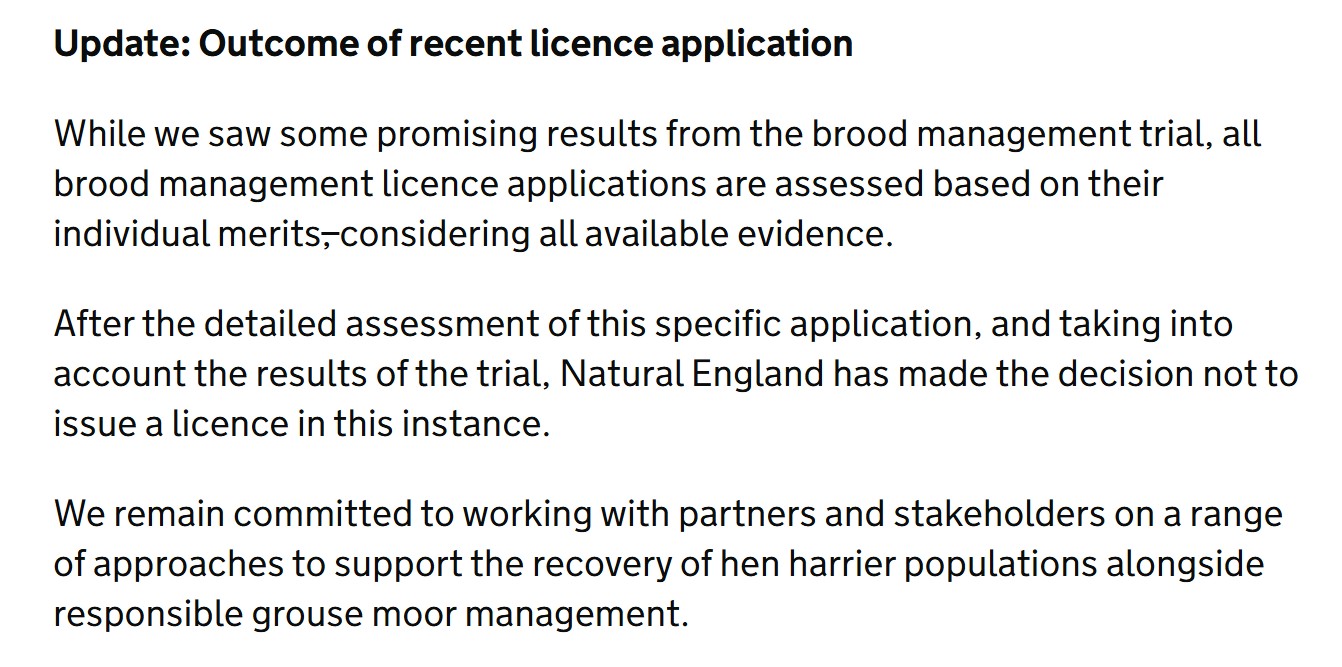
Today, Natural England has updated its hen harrier brood meddling blog with the following statement:
NE hasn’t provided any more detail about how it came to this very welcome decision but I have submitted an FoI and will publish NE’s response when it arrives.
Meanwhile, the Moorland Association has issued its own version of events about why its licence application was refused. I take everything the MA says with a dumper-truck-full of salt, given the reputation of its CEO for distorting and manipulating facts (e.g. see here and here).
According to this statement, the Moorland Association’s refusal to satellite tag brood meddled hen harriers was a factor in NE’s decision-making process. The Moorland Association says this:
“We proposed using high visibility leg tags because we have serious concerns about using satellite tags – particularly the added cost and complexity. We also have concerns about how satellite tracking data is [sic] being used to damage trust and increased [sic] tension“.
Er, nope. Satellite tag data are being used to demonstrate the ongoing and widespread criminal killing of hen harriers in and around many driven grouse moors. It’s the illegal killing (undertaken by gamekeepers on grouse moors) that’s damaging trust and increasing tension, not the use of satellite tag data!
At least 134 hen harriers ‘disappeared’/were illegally killed during the brood meddling trial, mostly on or close to grouse moors, and they’re just the ones we know about.
Incidentally, there’s news about a recent, very high profile case, coming shortly…
Meanwhile, I’m raising a glass to the end of hen harrier brood meddling (for this year, at least). It should never have started in the first place. Well done to all those who have campaigned so hard against it over the last seven years and shame on the individuals and organisations who facilitated this conservation sham.
Wild Justice’s petition calling for a ban on driven grouse shooting is nearing its 100,000-signature goal. It currently stands at 91,439. If you’d like to help it over the line, for the sake of future generations of hen harriers, please click here.
The RSPCA has issued an appeal for information following the discovery of a dead buzzard that is believed to have been shot.
The buzzard was found by a member of the public near Severn Trent’s Four Ashes Sewage Treatment Works on Enterprise Drive, Wolverhampton, on Wednesday 12 March 2025. It reportedly had ‘pellet wounds to its wing, body and head‘.
The shot buzzard. Photo by RSPCA
There isn’t any information about the type of weapon used (e.g. air rifle, shotgun etc). There were also reports of a second buzzard being killed in the same area but the RSPCA was unable to find a body.
Anyone with information about this incident should contact RSPCA’s appeal line number on 0300 123 8018, quoting incident number 01467643.
It probably won’t come as a surprise to anyone to learn that the UK Government, along with the Welsh and Scottish Governments, have missed the deadline (13 March 2025) to respond to the Health & Safety Executive’s recommendations for restrictions on the use of toxic lead ammunition, including a ban on the use of lead shot for live quarry shooting (see here for background).
Here is a press release from a consortium of campaigners who have been working on this issue for many years:
‘DELAYS MEAN DEATHS – BAN TOXIC LEAD AMMUNITION NOW’, EXPERTS URGE GOVERNMENT
Environmental charities and campaigners insist there is still time for the government to save thousands of waterbirds from needless and painful deaths despite another delay on the decision to ban toxic lead ammunition.
Steve Reed, Secretary of State for the Environment, Food and Rural Affairs, was expected to announce a decision on the future of lead ammunition on Thursday 13 March, but this deadline has been missed.
Dr Julia Newth, an expert on the impact of lead on birds at WWT, said: “In what has been a string of endless delays, this was the government’s chance to stand on the side of wildlife and choose a lead-free future – and yet, we’re still waiting for a decision.
“More delays will mean more unnecessary deaths. Ending the era of lead is in all of our interests and there’s still time for the government to show it is prepared to take this historic opportunity to rid society of toxic lead ammunition once and for all.”
Just last month, research by Cambridge University revealed five years of promises to phase out the toxic lead shot had failed spectacularly, despite industry pledges to comply (see here).
WWT, the charity for wetlands and wildlife, has been leading a coalition of charities and parliamentarians urging the government to bring in a full and swift ban of lead ammunition.
Earlier this year WWT, RSPB, Wildlife and Countryside Link, CHEM Trust and Wild Justice penned an open letter to Steve Reed calling for a transition period towards a full ban of lead shot of no more than 18 months.
Separate letters were sent to the respective Welsh and Scottish environment secretaries, who will play a key role in the final decision.
Following this, more than 14,000 people wrote to the Secretary of State calling for a swift and full ban on lead ammunition.
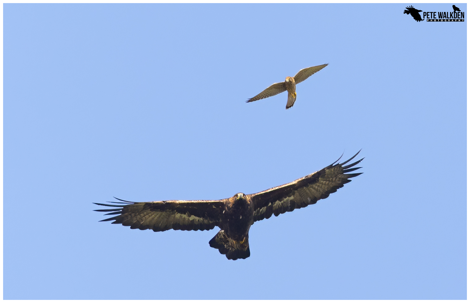
Golden eagles are particularly susceptible to lead poisoning. Photo by Pete Walkden
Richard Benwell, CEO of Wildlife and Countryside Link, said: “Toxic lead has been poisoning our environment and wildlife for far too long, so it’s disappointing that Government has missed the deadline to respond to recommendations to ban it in ammunition. “This would have been the first chemical ban or restriction the UK implemented since leaving the EU, compared to ten implemented on the continent. As the gap between the UK and EU on chemical safety gets ever bigger, we hope that ministers will get back on track, with a rapid ban on lead ammunition and alignment with the EU on the other toxic chemicals polluting UK waters, communities and wildlife.”
The RSPB’s Director of Conservation, Katie-Jo Luxton, said: “The case for ending toxic lead ammunition is clear. Shooting organisations themselves committed to phasing it out by 2025, so now is the time to act. We need swift action to ban lead, ensuring regulation follows urgently. With a legally binding target to halt species decline by 2030, the UK Government has a chance to eliminate a major threat with immediate effect.”
Dr Anna Watson, Director of Policy and Advocacy at CHEM Trust said: “This gives an alarming picture of how difficult it is to regulate harmful substances in the UK, now we have left the EU. The Government should ban toxic lead in ammunition to prevent the needless poisoning of tens of thousands of waterbirds.
“Our chemical regulatory system needs to get back on track to protect people and wildlife from harmful chemicals. The UK should adopt a strategic policy of matching or exceeding EU bans and other controls on harmful chemicals. This is the pragmatic way to prevent the long-term harm that will be caused by continuing with the current sluggish and inadequate approach.”
Dr Ruth Tingay, Co-Director of Wild Justice said: “The Secretary of State has many difficult decisions to make. This isn’t one of them. Does he want to protect wildlife, the environment and people from the poisonous effects of toxic lead ammunition, knowing that there are suitable alternatives readily available? The answer should be a quick, easy and resounding “YES”. How hard can it be?”
Lead is toxic and has been poisoning our countryside for decades, as a result of lead ammunition pellets discarded from shooting. Every year, 7,000 tonnes – about the weight of the Eiffel Tower – of poisonous lead is scattered into our environment.
ENDS
DEFRA has previously argued, whilst waiting for the recommendations from the HSE: “The use of lead shot in England and Wales is already legally prohibited in specific circumstances – including on all foreshores, and in or over specified sites of special scientific interest, predominantly wetlands“.
It’s accurate to say toxic lead shot ‘is already legally prohibited in specific circumstances’ but that statement needs to be put into context by including the phrase, “but we’re aware that compliance is very poorand so further legislation is obviously requiredurgently“.
Poor compliance has been evidenced by a number of scientific papers showing that the shooting industry is consistently failing to comply with current regulations on using lead ammunition in sensitive environments in England (here and here) and in Scotland (here).
And UK governments are consistently failing to act, even when they’ve been handed a golden opportunity to do so, as with the HSE recommendations.
This decision should be an absolute no-brainer and I can’t think of a single legitimate excuse for further delay.