
Over the last 17 years or so, satellite-tracking technology has revolutionised our understanding of not only hen harrier ecology, but also the persistent, illegal killing of these birds on driven grouse moors across the UK.
Two organisations have been at the forefront of hen harrier satellite tracking – Natural England and the RSPB (with significant help from raptor study groups and others).
For several years now, Natural England has been intermittently publishing the fates of the hen harriers it’s team has tagged (see here), but only with vague explanations about its definition of the category, ‘Missing, Fate Unknown’ (e.g. see here).
Of course, since then, a significant academic paper published in 2019 demonstrated what we all already knew – that patterns of satellite-tagged hen harrier disappearances suggested widespread illegal killing on British grouse moors (see here).
A further paper, published in 2023 and this time analysing the fates of hen harriers tagged by the RSPB, reached the same conclusion (see here).
Since 2018, I have been publishing details about the confirmed/suspected deaths of satellite-tagged (and a few untagged) hen harriers using data from both Natural England and the RSPB (this list currently stands at 130 illegally killed/’missing’ hen harriers although there are still more to add; those data are currently being withheld from the public – see here).
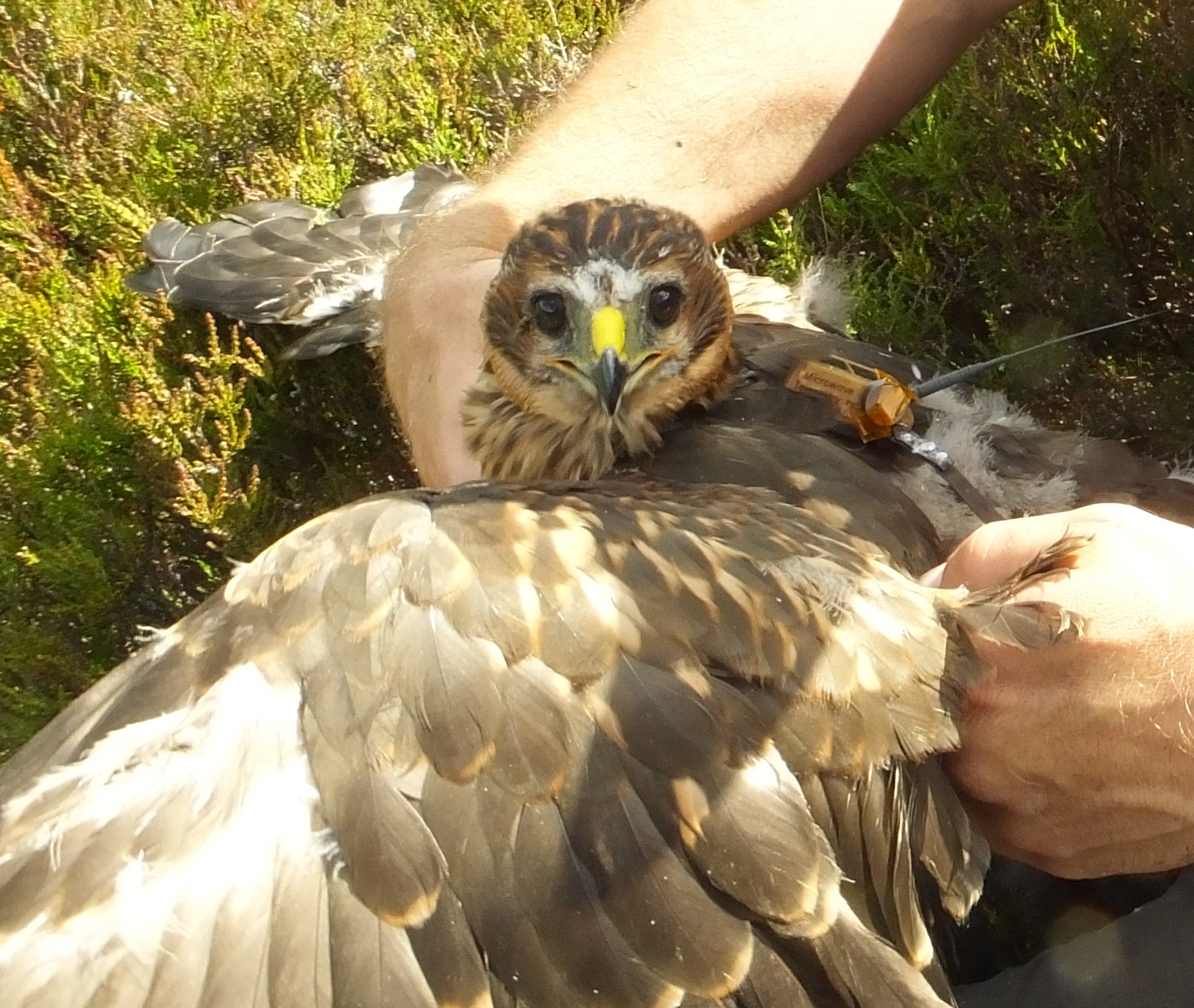
Now, for the first time, the RSPB has launched an interactive map hub showing the fates of hen harriers its team has satellite-tagged since 2014 (currently up to October 2024).
The RSPB’s interactive database includes the fates of 178 of the 226 hen harriers satellite-tagged so far. Some dead hen harriers are not included as they are subject to ongoing police investigations. The hen harriers that are still alive and are currently being tracked are also not included, for what should be obvious reasons.

The interactive map hub allows users to filter the ‘fates’ of the RSPB’s tagged hen harriers into five different categories:
- Confirmed Illegal persecution
- Stop no malfunction (where the bird has disappeared in suspicious circumstances)
- Natural
- Unknown
- Tag failure/expired
Detailed explanations of each of these categories are provided on the hub.
Users are also able to zoom in to the map to show the general area where a harrier died and you can manipulate the map to show terrain etc.
This facility is a useful and welcome addition to the public record on the fates of individual satellite-tracked hen harriers in the UK. I’m not sure it provides us with any wider, big-picture information that we don’t already know but that’s probably not the intention behind this interactive hub anyway. What it does do is provide the public with a level of detail to help them understand the scale of satellite-tagging efforts on the UK’s hen harriers and thus the veracity of the extent of the ongoing illegal killing of this species on many driven grouse moors.
To visit the interactive map hub, click here.
To read the RSPB’s blog about the map hub, click here.
For those who want to see an end to hen harrier persecution, please consider signing this petition calling for a ban on driven grouse shooting – HERE.

NE should have had this years ago, after all their tagging project is “ours”. I would like to see RSPB add other searchable layers for the cases & recovered dead of Buzzards, SEO, Sparrowhawks, Goshawks, Ravens, Red Kites, etc to make the thing complete. I think there was a non-interactive map of persecution somewhere on RSPB website along these lines. I admit I haven’t searched it out as it continually frustrates me that this stuff is never straightforward to find on RSPB site.
Natural England do not seem to care and seem to be a waste of corrupt space there seems to be no organisations to trust . I don’t trust anyone there is more to it than we will ever be privvy to . Until driven grouse shooting is banned these birds wildlife will never be safe .